


Auf der Suche nach dem Radfernweg Berlin-Leipzig.
Diesmal habe ich bewusst die Wegsuche kurz nach Berlin übersprungen. Der Radfernweg ist dort lausig ausgeschildert und nicht besonders schön. Ich suchte also nach einer Alternativstrecke bis zum FlämingSkate.
Zugegeben, auch bei dieser Variante ist nicht alles Gold was glänzt. Es ist eine Passage nach dem Bahnhof Grossbeeren drin die etwas ungewohnt ist. Der Track neben der Bahn verläuft zum Schluss auf dem Kabelkanal der Bahntrasse bevor auf eine alte Chaussee über eine steile Böschung gewechselt wird.
Später folgt nach Schönhagen eine Zuckersandstrecke. Aber auch das geht vorüber.
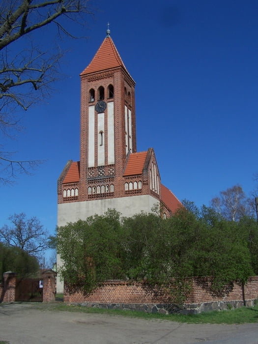
Sehenswert ist die Kirche in Kietz. Diese Kirche wird sogar hin und wieder als Filmkirche benutzt.
Further information at
http://de.wikipedia.org/wiki/LuckenwaldeGaleria trasy


Mapa trasy i profil wysokości
Minimum height 30 m
Maximum height 68 m
More about the tour author
|
|
Pheinz |
Komentarze

Einfach losradeln
GPS tracks
Trackpoints-
GPX / Garmin Map Source (gpx) download
-
TCX / Garmin Training Center® (tcx) download
-
CRS / Garmin Training Center® (crs) download
-
Google Earth (kml) download
-
G7ToWin (g7t) download
-
TTQV (trk) download
-
Overlay (ovl) download
-
Fugawi (txt) download
-
Kompass (DAV) Track (tk) download
-
Karta trasy (pdf) download
-
Original file of the author (gpx) download
More about the tour author
|
|
Pheinz |
Add to my favorites
Remove from my favorites
Edit tags
Open track
My score
Rate