Login

Zapomniałeś swój login?

Cookies have to be accepted!
Your browser's cookie functionality is disabled. Please enable this functionality.

Not a member yet?

Register now
Login

Available for registred users only

Log in to use this feature.

Zapomniałeś swój login?

Cookies have to be accepted!
Your browser's cookie functionality is disabled. Please enable this functionality.

Not a member yet?

Register now
Filter
Kategorie
Advanced filters
  • Długość (km)
  • Wysokość
Zapisz filtr Reset filter

TrackRank

QRCode

Technical data

Długość28,8 km Wysokość606 m Way down548 m Czas trwania00:00 h:m Data23.04.2011
Oceny Author Krajobraz Czynnik zadowolenia Kondycja Technika

Statystyka

1030 Widoki Oceny 206 Downloads / Pliki do pobrania Przeciętnie
Rate
  • Karta trasy
  • Dojazd
  • Downloads / Pliki do pobrania
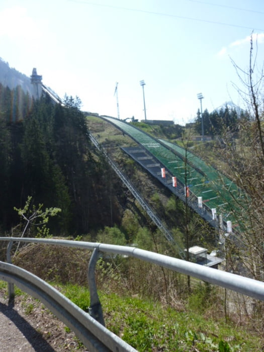
Einsteigertour mit gemütlichen Einradeln auf dem Illerdamm bevor es zur Sache kommt.Vorbei an den Sprungschanzen über den Walraffweg zur Gaisalpe.

Galeria trasy

Mapa trasy i profil wysokości

  • Open Street Map
  • Google
Minimum height 691 m Maximum height 1193 m Widok szczegółowy

More about the tour author

Winnipooh
Member since 2011

Send private message

Komentarze

Startpunkt ist in Sonthofen. (Parkplatz Wonnemar)

GPS tracks

Trackpoints
  • GPX / Garmin Map Source (gpx) download
  • TCX / Garmin Training Center® (tcx) download
  • CRS / Garmin Training Center® (crs) download
  • Google Earth (kml) download
  • G7ToWin (g7t) download
  • TTQV (trk) download
  • Overlay (ovl) download
  • Fugawi (txt) download
  • Kompass (DAV) Track (tk) download
  • Karta trasy (pdf) download
  • Original file of the author (gpx) download

More about the tour author

Winnipooh
Member since 2011

Send private message
Share track
Add to my favorites
Remove from my favorites
Edit tags
My score
Rate
Trasa: Über den Walraffweg zur Gaisalpe
Rodzaj: Rower górski (MTB)
Długość: 28,8 km
Evaluated on:
Czas trwania:
Day(s)
Hour(s)
Minute(s)
Ocena: Krajobraz Czynnik zadowolenia Kondycja Technika