


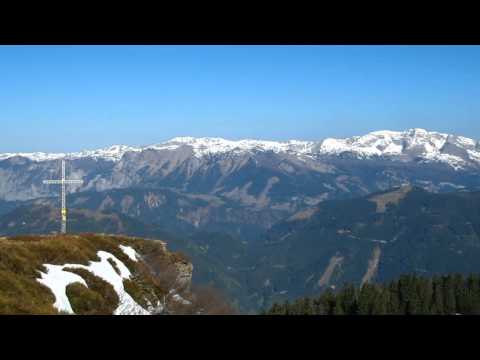
Der Dürrenschöberl (1.737m) ist der Hausberg in Selzthal. Der 6,4km lange, mittelschwere Wanderweg weißt keine technischen Schwierigkeiten auf. Es gibt mit Ausnahme der Nordseite des großflächigen Gipfelbereichs keine gefährlichen Stellen. So können auch jene die nicht schwindelfrei sind diesen Gipfel erklimmen und das traumhaft schöne Panorama genießen.
mehr infos und fotos findest du auf biketour4you.at
The mountain Dürrenschöberl (1.737m) is the most important mountain in Selzthal. The moderate hiking trail is 6,4 km long and has no technical difficulties. It is with exception of the north side of the large summit area with no dangerous places. Thus, even those who are not afraid of heights can climb this summit and would see the gorgeous panorama.
more infos and photos you'll see on biketours4you.at
Galeria trasy

Mapa trasy i profil wysokości
Minimum height 636 m
Maximum height 1740 m
More about the tour author
|
|
Trek1400d |
Komentarze

GPS tracks
Trackpoints-
GPX / Garmin Map Source (gpx) download
-
TCX / Garmin Training Center® (tcx) download
-
CRS / Garmin Training Center® (crs) download
-
Google Earth (kml) download
-
G7ToWin (g7t) download
-
TTQV (trk) download
-
Overlay (ovl) download
-
Fugawi (txt) download
-
Kompass (DAV) Track (tk) download
-
Karta trasy (pdf) download
-
Original file of the author (gpx) download
More about the tour author
|
|
Trek1400d |
Add to my favorites
Remove from my favorites
Edit tags
Open track
My score
Rate