


Netter Feierabenturn mit Start in Furth.
Es geht durch Schwanstetten und dann durch den schönen Lacher Forst über den Forst Brunnau zum Rothsee.
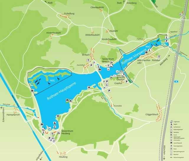
Um den Rothsee herum und über Harrlach zurück nach Furth.
In Furth bei Linde lohnt eine Einkehr :-) schöner Biergarten und in jedem Fall gutes Essen!!!
Die Wege sind gut befahrbar und es bieten sich auch einige Trails an, z.B. am Rothsee Seebühler-Weg oder von Heuberg weg fahren - das ist jedoch nicht in diesem Track enthalten, einfach ausprobieren.
Es geht durch Schwanstetten und dann durch den schönen Lacher Forst über den Forst Brunnau zum Rothsee.
Um den Rothsee herum und über Harrlach zurück nach Furth.
In Furth bei Linde lohnt eine Einkehr :-) schöner Biergarten und in jedem Fall gutes Essen!!!
Die Wege sind gut befahrbar und es bieten sich auch einige Trails an, z.B. am Rothsee Seebühler-Weg oder von Heuberg weg fahren - das ist jedoch nicht in diesem Track enthalten, einfach ausprobieren.
Further information at
http://www.bike-people.deGaleria trasy
Mapa trasy i profil wysokości
Minimum height 342 m
Maximum height 419 m
More about the tour author

|
Disman |
Komentarze

Start ist an der Linde in Furth am Gasthaus, in Richtung Schwanstetten. Parkplätze sind vorhanden, falls nötig.
GPS tracks
Trackpoints-
GPX / Garmin Map Source (gpx) download
-
TCX / Garmin Training Center® (tcx) download
-
CRS / Garmin Training Center® (crs) download
-
Google Earth (kml) download
-
G7ToWin (g7t) download
-
TTQV (trk) download
-
Overlay (ovl) download
-
Fugawi (txt) download
-
Kompass (DAV) Track (tk) download
-
Karta trasy (pdf) download
-
Original file of the author (gpx) download
More about the tour author
|
|
Disman |
Add to my favorites
Remove from my favorites
Edit tags
Open track
My score
Rate