Login

Zapomniałeś swój login?

Cookies have to be accepted!
Your browser's cookie functionality is disabled. Please enable this functionality.

Not a member yet?

Register now
Login

Available for registred users only

Log in to use this feature.

Zapomniałeś swój login?

Cookies have to be accepted!
Your browser's cookie functionality is disabled. Please enable this functionality.

Not a member yet?

Register now
Filter
Kategorie
Advanced filters
  • Długość (km)
  • Wysokość
Zapisz filtr Reset filter

TrackRank

QRCode

Technical data

Długość38,4 km Wysokość759 m Way down758 m Czas trwania03:20 h:m Data01.05.2011
Oceny Author Krajobraz Czynnik zadowolenia Kondycja Technika

Statystyka

1181 Widoki Oceny 108 Downloads / Pliki do pobrania Przeciętnie
Rate
  • Karta trasy
  • Dojazd
  • Downloads / Pliki do pobrania
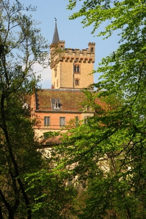
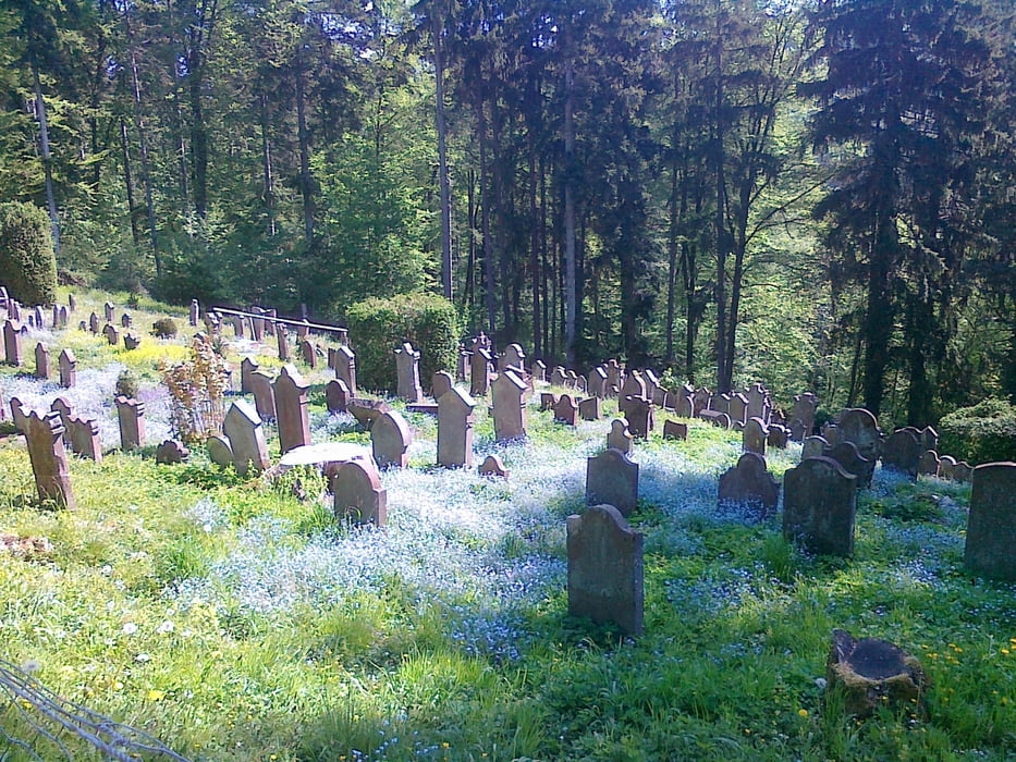
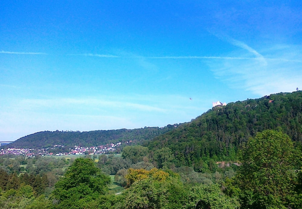
Start in Haigerloch Weildorf - übers Laibertäle nach Bad Imnau ins Eyachtal. Anschliessend Richtung Mühringen und am Friedhof vorbei hinauf nach Felldorf. Weiter nach Bierlingen und über eine Single Trail Abfahrt ins Neckartal. Am Golfclub Weitenburg vorbei nach Sulzau im Neckartal. Auffahrt zur Weitenburg und über Singeltrail Richtung Börstingen. Rückfahrt im Neckartal über Eyach. Weiter am jüdischen Friedhof von Mühringen vorbei und nach Mühringen. Hier hat meinen einen schönen Blick aufs Schloß. Anschliessed über Wiesenstetten zurück nach Haigerloch.

Galeria trasy

Mapa trasy i profil wysokości

  • Open Street Map
  • Google
Minimum height 361 m Maximum height 535 m Widok szczegółowy

More about the tour author

apfister
Member since 2010

Send private message

Komentarze

Gość on 04.08.2019

Danke

Wir sind heute zu zweit diese Runde nachgefahren. Meine Frau war begeistert über die Landschaft und Farben usw.
Sie ist auch für weniger versierte MTB'ler gut zu fahren.

GPS tracks

Trackpoints
  • GPX / Garmin Map Source (gpx) download
  • TCX / Garmin Training Center® (tcx) download
  • CRS / Garmin Training Center® (crs) download
  • Google Earth (kml) download
  • G7ToWin (g7t) download
  • TTQV (trk) download
  • Overlay (ovl) download
  • Fugawi (txt) download
  • Kompass (DAV) Track (tk) download
  • Karta trasy (pdf) download
  • Original file of the author (gpx) download

More about the tour author

apfister
Member since 2010

Send private message
Share track
Add to my favorites
Remove from my favorites
Edit tags
My score
Rate
Trasa: Haigerloch - Schloss Mühringen - Weitenburg
Rodzaj: Rower górski (MTB)
Długość: 38,4 km
Evaluated on:
Czas trwania:
Day(s)
Hour(s)
Minute(s)
Ocena: Krajobraz Czynnik zadowolenia Kondycja Technika