Login

Zapomniałeś swój login?

Cookies have to be accepted!
Your browser's cookie functionality is disabled. Please enable this functionality.

Not a member yet?

Register now
Login

Available for registred users only

Log in to use this feature.

Zapomniałeś swój login?

Cookies have to be accepted!
Your browser's cookie functionality is disabled. Please enable this functionality.

Not a member yet?

Register now
Filter
Kategorie
Advanced filters
  • Długość (km)
  • Wysokość
Zapisz filtr Reset filter

TrackRank

QRCode

Technical data

Długość93,3 km Wysokość1121 m Way down1116 m Czas trwania06:00 h:m Data16.05.2007
Oceny Author Krajobraz Czynnik zadowolenia Kondycja Technika

Statystyka

1632 Widoki 1 Ocena 142 Downloads / Pliki do pobrania 4.00 Przeciętnie
Rate
  • Karta trasy
  • Dojazd
  • Downloads / Pliki do pobrania
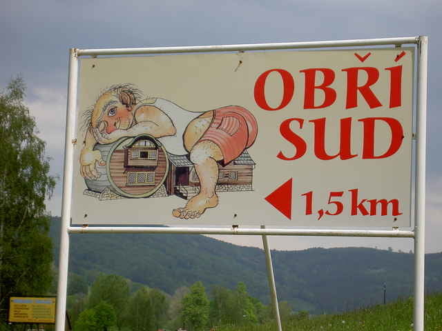
Von Oybin zum Drei Ländereck, Deutschland, Tschechien/ Polen über Grabstein, Vaclavice, Hejenice zum Lokal Großen Fass in Lazne Libverda. Grenzübertritt nach Tscechien und Polen. Zum Mittagessen in Tschechien zum Großen Fass. ACHTUNG: Montag Ruhetag. Zurück entlang des Flusses Smeda über Raspenva, Freydlant, Detrichov, Hermaniche, nach Polen. Weiter nach Bogatynia, Opolno Zdroy, Kopaczow und mit Grenzübertritt am Fluss Neiss zurück nachz Oybin.

Further information at

http://www.biketreff-niefern.de

Galeria trasy

Mapa trasy i profil wysokości

  • Open Street Map
  • Google
Minimum height 232 m Maximum height 650 m Widok szczegółowy

More about the tour author

winklem
Member since 2005

Send private message

Komentarze

Start in Oybin.

GPS tracks

Trackpoints
  • GPX / Garmin Map Source (gpx) download
  • TCX / Garmin Training Center® (tcx) download
  • CRS / Garmin Training Center® (crs) download
  • Google Earth (kml) download
  • G7ToWin (g7t) download
  • TTQV (trk) download
  • Overlay (ovl) download
  • Fugawi (txt) download
  • Kompass (DAV) Track (tk) download
  • Karta trasy (pdf) download
  • Original file of the author (g7t) download

More about the tour author

winklem
Member since 2005

Send private message
Share track
Add to my favorites
Remove from my favorites
Edit tags
My score
Rate
Trasa: Von Oybin zum Großen Fass "Obri Sud" in Tschechien und durch Polen
Rodzaj: Rower górski (MTB)
Długość: 93,3 km
Evaluated on:
Czas trwania:
Day(s)
Hour(s)
Minute(s)
Ocena: Krajobraz Czynnik zadowolenia Kondycja Technika