Login

Zapomniałeś swój login?

Cookies have to be accepted!
Your browser's cookie functionality is disabled. Please enable this functionality.

Not a member yet?

Register now
Login

Available for registred users only

Log in to use this feature.

Zapomniałeś swój login?

Cookies have to be accepted!
Your browser's cookie functionality is disabled. Please enable this functionality.

Not a member yet?

Register now
Filter
Kategorie
Advanced filters
  • Długość (km)
  • Wysokość
Zapisz filtr Reset filter

TrackRank

QRCode

Technical data

Długość11,9 km Wysokość598 m Way down563 m Czas trwania04:00 h:m Data21.05.2011
Oceny Author User Krajobraz Czynnik zadowolenia Kondycja Technika

Statystyka

1830 Widoki 2 Oceny 252 Downloads / Pliki do pobrania 3.00 Przeciętnie
Rate
  • Karta trasy
  • Dojazd
  • Downloads / Pliki do pobrania

Von Parkplatz Gfäll zum Gipfel des Gr. Rachel.

Anstrengende Tour zum höchsten Gipfel des Nationalparkes Bayerischer Wald.
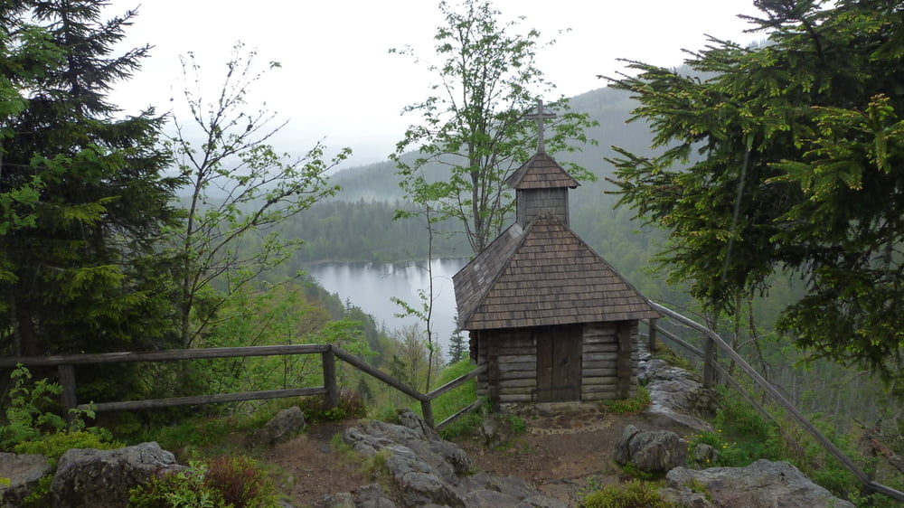
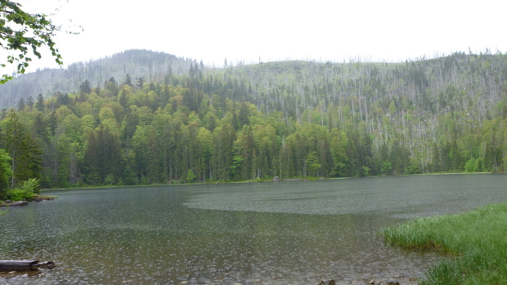
Nach anstrengenden 3km mit steilen Aufstieg, erreicht man das Waldschmidthaus (gemütliche Einkehr möglich). Vom Waldschmidthaus geht man noch ca. 20min zum Gipfel des Gr. Rachel. Der Ausblick auf Bayer- und Böhmerwald ist großartig. Vom Gipfel gehts steil bergab - festes Schuhwerk unbedingt erforderlich - zur Rachelkapelle und zum Rachelsee. Ab Rachelsee klingt die Wanderung gemütlich aus zurück zum Parkplatz Gfäll.


Galeria trasy

Mapa trasy i profil wysokości

  • Open Street Map
  • Google
Minimum height 943 m Maximum height 1457 m Widok szczegółowy

More about the tour author

preiste
Member since 2010

Send private message

Komentarze

Nachtfarben on 22.10.2016

Dublikat

diese Tour ist, wenn man die Tracks vergleicht, identisch mit Tour #66298: Rachel Rundwanderweg. Einziger Unterschied ist, dass sie in der Gegenrichtung gegangen wurde.
 P+R Spiegelau - mit Igelbus zum Parkplatz Gfäll

GPS tracks

Trackpoints
  • GPX / Garmin Map Source (gpx) download
  • TCX / Garmin Training Center® (tcx) download
  • CRS / Garmin Training Center® (crs) download
  • Google Earth (kml) download
  • G7ToWin (g7t) download
  • TTQV (trk) download
  • Overlay (ovl) download
  • Fugawi (txt) download
  • Kompass (DAV) Track (tk) download
  • Karta trasy (pdf) download
  • Original file of the author (tcx) download

More about the tour author

preiste
Member since 2010

Send private message
Share track
Add to my favorites
Remove from my favorites
Edit tags
My score
Rate
Trasa: Gr. Rachel
Rodzaj: Wędrówki
Długość: 11,9 km
Evaluated on:
Czas trwania:
Day(s)
Hour(s)
Minute(s)
Ocena: Krajobraz Czynnik zadowolenia Kondycja Technika