


Date: April 23, 2011
Start: 1204 m (mountain station of Salamander Sesselbahn)
Finish: 872 m (lower station of Salamander Sesselbahn)
Highest point: 2047 m
Lowest point: 872 m
Total ascent: 1189 m
Total descent: 1521 m
Information about the Salamander Sesselbahn:
http://www.schneebergbahn.at
Webcams:
http://www.schneeberg.tv
Further information at
http://www.beepee.hu/v/turak/schneeberg1104/Galeria trasy


Mapa trasy i profil wysokości
Minimum height 873 m
Maximum height 2048 m
More about the tour author
|
|
beepee |
Komentarze

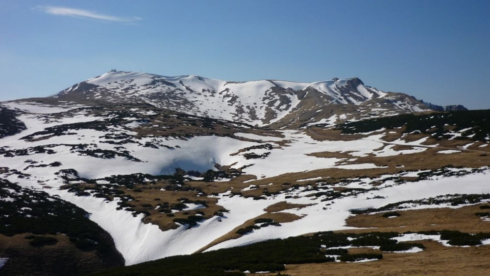
Another nice tour on and around Schneeberg.
Up via Fadensteig to Fischerhütte.
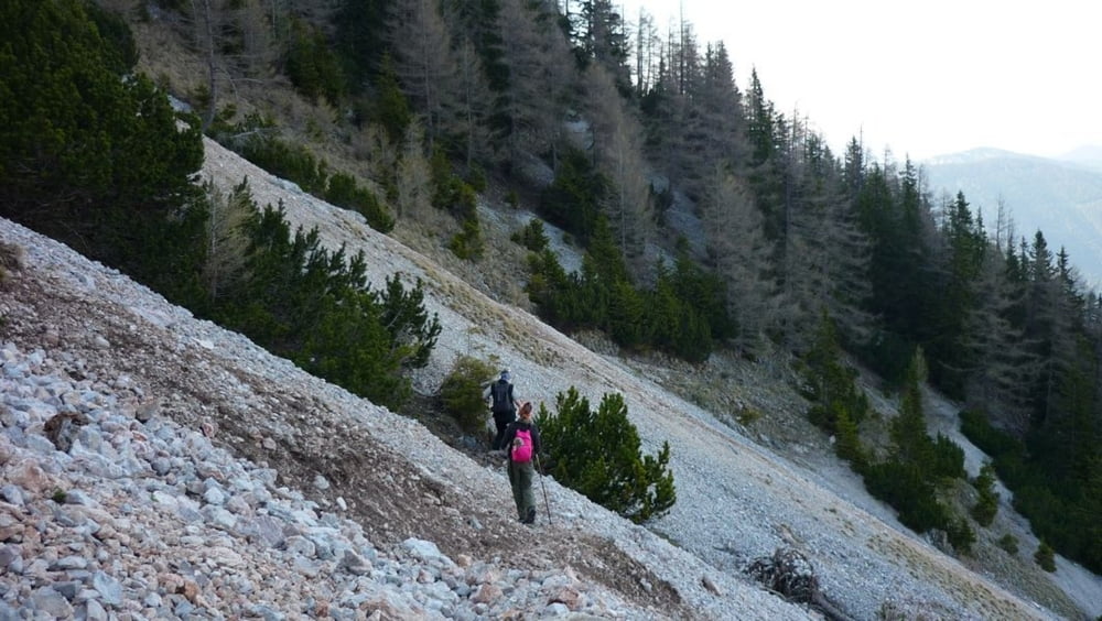
Down from Fischerhütte by Damböckhaus to the mountain station of the Salamander Railway, then down towards Baumgartner Station. Right before Baumgartner, head towards Nördlicher Grafensteig. Follow the trail, then turn right towards Losenheim (instead of going straight to Edelweisshütte). The last few kms are in a forest, then on a dirt road.
Between the mountain station of Salamander Railway and Baumgartner Station, there is also a shorter route, marked with yellow. You can take it, instead of going on the longer route like we did. Look at the map and it will be clear...
Please start the tour earlier than we did, or go much faster. We started at 10:40, and finished at 21:35, ending up in a hurry on Nördlicher Grafenstaig, to reach the end of the rocky area before sunset, and walking the last hour with headlights.
GPS tracks
Trackpoints-
GPX / Garmin Map Source (gpx) download
-
TCX / Garmin Training Center® (tcx) download
-
CRS / Garmin Training Center® (crs) download
-
Google Earth (kml) download
-
G7ToWin (g7t) download
-
TTQV (trk) download
-
Overlay (ovl) download
-
Fugawi (txt) download
-
Kompass (DAV) Track (tk) download
-
Karta trasy (pdf) download
-
Original file of the author (gpx) download
More about the tour author
|
|
beepee |
Add to my favorites
Remove from my favorites
Edit tags
Open track
My score
Rate