


Diese kurze Tour hat als Höhepunkt den Trail über die Felsflächen. Da dieser Trail sehr schwierig ist, sollte er nur erfahrenen Bikern vorbehalten bleiben.
Start der Tour: Via Lungo Sarca, Arco (Torbole sul Garda).
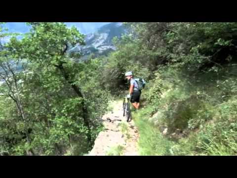
Nach gemütlichem Einrollen am Seeufer verläuft der Weg über die Via Bellavista und die Monte Baldo Straße nach Malga Zures. Hier kommt man über eine Schotterstraße zum Einstieg in den Trail. Jetzt heißt es volle Konzentration und immer nach rechts orientieren. Ein Abrutschen über die Felsflächen wäre sicherlich sehr unangenehm.
Zum Abschluss der Tour geht es noch kurz zum Castel Penede und dann vorbei am Marmitte dei Giganti über einen schmalen Trail zurück ins Hotel.
Start der Tour: Via Lungo Sarca, Arco (Torbole sul Garda).
Nach gemütlichem Einrollen am Seeufer verläuft der Weg über die Via Bellavista und die Monte Baldo Straße nach Malga Zures. Hier kommt man über eine Schotterstraße zum Einstieg in den Trail. Jetzt heißt es volle Konzentration und immer nach rechts orientieren. Ein Abrutschen über die Felsflächen wäre sicherlich sehr unangenehm.
Zum Abschluss der Tour geht es noch kurz zum Castel Penede und dann vorbei am Marmitte dei Giganti über einen schmalen Trail zurück ins Hotel.
Further information at
http://www.Schliesser-Bike.deGaleria trasy


Mapa trasy i profil wysokości
Minimum height 67 m
Maximum height 683 m
More about the tour author
|
|
mtb-tom |
Komentarze

Start der Tour: Via Lungo Sarca, Arco (Torbole sul Garda).
GPS tracks
Trackpoints-
GPX / Garmin Map Source (gpx) download
-
TCX / Garmin Training Center® (tcx) download
-
CRS / Garmin Training Center® (crs) download
-
Google Earth (kml) download
-
G7ToWin (g7t) download
-
TTQV (trk) download
-
Overlay (ovl) download
-
Fugawi (txt) download
-
Kompass (DAV) Track (tk) download
-
Karta trasy (pdf) download
-
Original file of the author (gpx) download
More about the tour author
|
|
mtb-tom |
Add to my favorites
Remove from my favorites
Edit tags
Open track
My score
Rate