


Die Tour wurde ohne GPS gefahren.
Die GPS Daten wurden nachträglich zusammengestellt
Vorsicht, ein Teilstück hat keine geographischen Punkte, diese Teilstück muss beim übertragen auf das Gerät abgetrennt werden sonst funzt das nicht, zumindest bei mir nicht.
1.Tag 85km 1034 km
Garmisch Landeck
2.Tag 82 km 1849 hm
Landeck Uina Schlinig
3. Tag 60 km 1964hm
Schlinig Santa Maria Umbrail Villa Valania
4. Tag 54 km 1745 hm
Villa Valania – Paso Verva – Grosio – Val di Rezzalo – La Baita
5. Tag 56 km 1966 hm
La Baita – Paso del Alpe – Paso Gavia – Pso Montozzo- Pejo Cogolo
6. Tag 37 km 974 hm
Pejo Cogolo – Dimaro – Madonna di Campiglio
7. Tag 104 km 1162 hm
Mad. D. Camp. – Lago Val di Agola – Passo del Ors – Malga Moldiva - Torbole - Rovereto
8. Tag
Rovereto – Brenner (Bahnfahrt)– Insbruck - Garmisch(Bahnfahrt)
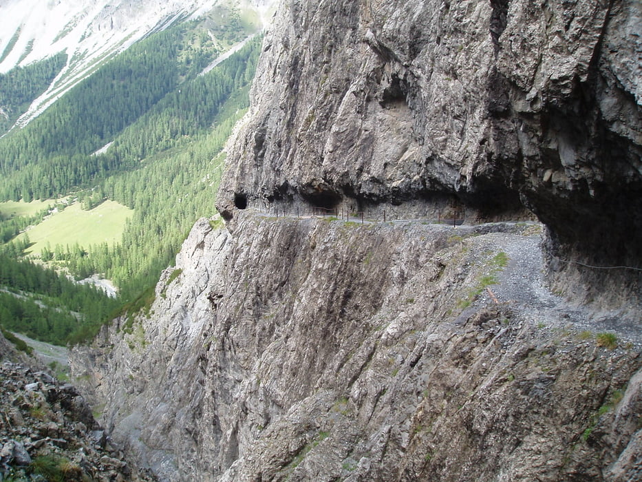
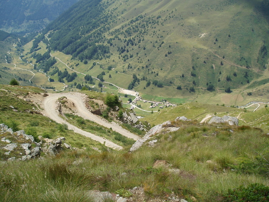
Galeria trasy


Mapa trasy i profil wysokości
Minimum height 75 m
Maximum height 2630 m
More about the tour author

|
tigris955 |
Komentarze

GPS tracks
Trackpoints-
GPX / Garmin Map Source (gpx) download
-
TCX / Garmin Training Center® (tcx) download
-
CRS / Garmin Training Center® (crs) download
-
Google Earth (kml) download
-
G7ToWin (g7t) download
-
TTQV (trk) download
-
Overlay (ovl) download
-
Fugawi (txt) download
-
Kompass (DAV) Track (tk) download
-
Karta trasy (pdf) download
-
Original file of the author (gpx) download
More about the tour author
|
|
tigris955 |
Add to my favorites
Remove from my favorites
Edit tags
Open track
My score
Rate