Login

Zapomniałeś swój login?

Cookies have to be accepted!
Your browser's cookie functionality is disabled. Please enable this functionality.

Not a member yet?

Register now
Login

Available for registred users only

Log in to use this feature.

Zapomniałeś swój login?

Cookies have to be accepted!
Your browser's cookie functionality is disabled. Please enable this functionality.

Not a member yet?

Register now
Filter
Kategorie
Advanced filters
  • Długość (km)
  • Wysokość
Zapisz filtr Reset filter

TrackRank

QRCode

Technical data

Długość54,9 km Wysokość1032 m Way down1026 m Czas trwania05:00 h:m Data22.06.2011
Oceny Author Krajobraz Czynnik zadowolenia Kondycja Technika

Statystyka

4247 Widoki Oceny 276 Downloads / Pliki do pobrania Przeciętnie
Rate
  • Karta trasy
  • Dojazd
  • Downloads / Pliki do pobrania

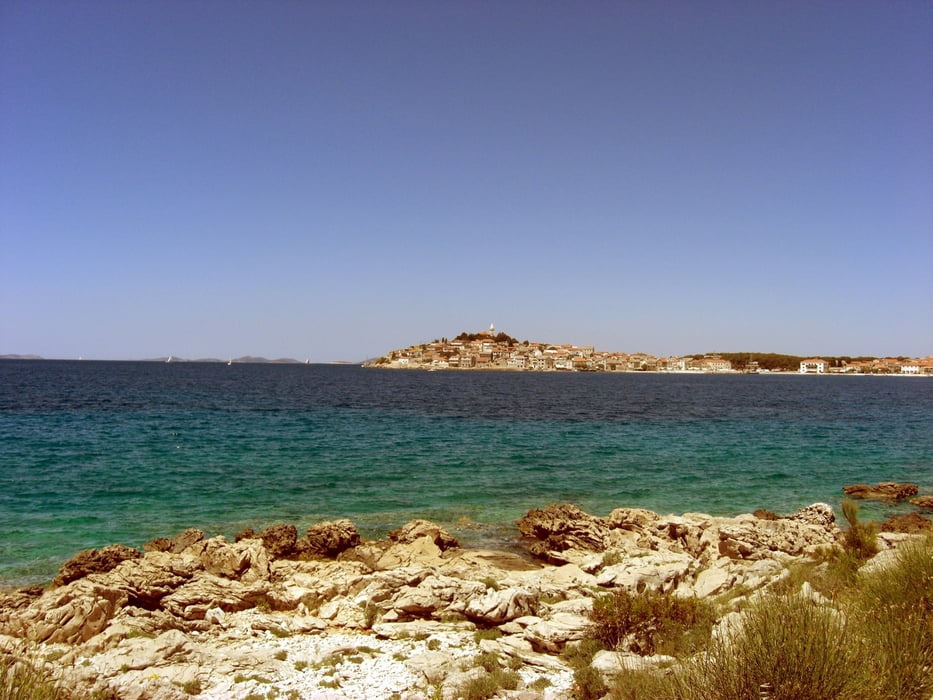
Gleich nach dem Start geht es auf einer einsamen Teerstrase den Berg hoch. Abfahrt nach Primosteen dann auf Feldwegen. Das Stück am Meer hinter Primosten ist traumhaft. Dann wird es richtig einsam, fast nur noch Feldwege und verlassene Pfade.

Oben in den Hügeln kann es recht warm werden, genügend Wasser mitnehmen. Ich war im Juni unterwegs, da habe ich 4 Liter gebraucht (war aber ein heißer Tag).

Galeria trasy

Mapa trasy i profil wysokości

  • Open Street Map
  • Google
Minimum height -8 m Maximum height 292 m Widok szczegółowy

More about the tour author

alauchner
Member since 2009

Send private message

Komentarze

samotschi on 29.04.2017

Super Tour

Besten Dank für die super Tour, geniale Gegend, aber ohne GPS würde ich mich nicht hinaus trauen.... :-)
Start in Grebastica am Strand. Da gibt es viele Parkplätze und nach der Tour kann man gleich ins Wasser zum Erfrischen.

GPS tracks

Trackpoints
  • GPX / Garmin Map Source (gpx) download
  • TCX / Garmin Training Center® (tcx) download
  • CRS / Garmin Training Center® (crs) download
  • Google Earth (kml) download
  • G7ToWin (g7t) download
  • TTQV (trk) download
  • Overlay (ovl) download
  • Fugawi (txt) download
  • Kompass (DAV) Track (tk) download
  • Karta trasy (pdf) download
  • Original file of the author (gpx) download

More about the tour author

alauchner
Member since 2009

Send private message
Share track
Add to my favorites
Remove from my favorites
Edit tags
My score
Rate
Trasa: Primosten Hinterland
Rodzaj: Rower górski (MTB)
Długość: 54,9 km
Evaluated on:
Czas trwania:
Day(s)
Hour(s)
Minute(s)
Ocena: Krajobraz Czynnik zadowolenia Kondycja Technika