Login

Zapomniałeś swój login?

Cookies have to be accepted!
Your browser's cookie functionality is disabled. Please enable this functionality.

Not a member yet?

Register now
Login

Available for registred users only

Log in to use this feature.

Zapomniałeś swój login?

Cookies have to be accepted!
Your browser's cookie functionality is disabled. Please enable this functionality.

Not a member yet?

Register now
Filter
Kategorie
Advanced filters
  • Długość (km)
  • Wysokość
Zapisz filtr Reset filter

TrackRank

QRCode

Technical data

Długość110,7 km Wysokość3922 m Way down3901 m Czas trwania10:00 h:m Data28.07.2011
Oceny Author Krajobraz Czynnik zadowolenia Kondycja Technika

Statystyka

1183 Widoki Oceny 178 Downloads / Pliki do pobrania Przeciętnie
Rate
  • Karta trasy
  • Dojazd
  • Downloads / Pliki do pobrania

Achtung!!!!!

Wir haben uns am Passo Silvella verfahren und sind die Forststrasse nach candide runtergefahren und sind tort wieder auf die originalstrecke gekommen !!!!

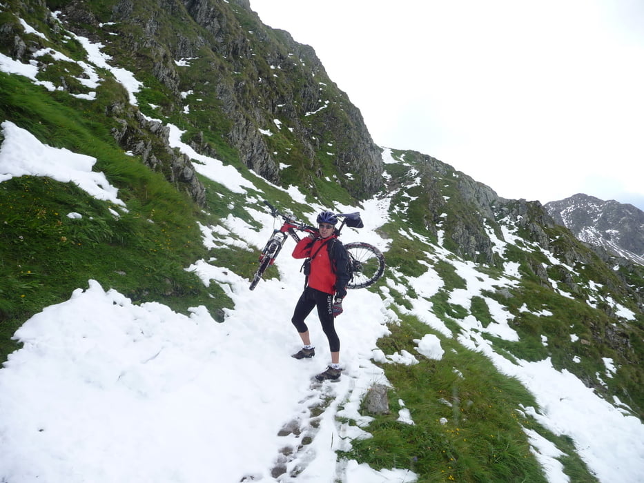
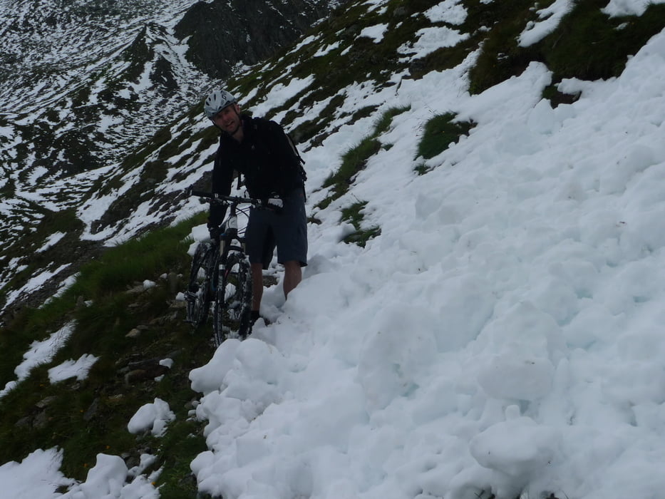
Stonemantrial in einem Tag ab der Sillianhuette Schnee !!!! fast nur zum tragen über die ganze Demutpassage bis zu den tibetischen Flaggen ! Aber haben es trotz widigsten Bedingungen geschafft!!!

Danke an meinen Partner- Tosti

Galeria trasy

Mapa trasy i profil wysokości

  • Open Street Map
  • Google
Minimum height 1078 m Maximum height 2546 m Widok szczegółowy

More about the tour author

Bergrettungstmk
Member since 2008

Send private message

Komentarze

GPS tracks

Trackpoints
  • GPX / Garmin Map Source (gpx) download
  • TCX / Garmin Training Center® (tcx) download
  • CRS / Garmin Training Center® (crs) download
  • Google Earth (kml) download
  • G7ToWin (g7t) download
  • TTQV (trk) download
  • Overlay (ovl) download
  • Fugawi (txt) download
  • Kompass (DAV) Track (tk) download
  • Karta trasy (pdf) download
  • Original file of the author (gpx) download

More about the tour author

Bergrettungstmk
Member since 2008

Send private message
Share track
Add to my favorites
Remove from my favorites
Edit tags
My score
Rate
Trasa: Stonemantrial
Rodzaj: Rower górski (MTB)
Długość: 110,7 km
Evaluated on:
Czas trwania:
Day(s)
Hour(s)
Minute(s)
Ocena: Krajobraz Czynnik zadowolenia Kondycja Technika