Login

Zapomniałeś swój login?

Cookies have to be accepted!
Your browser's cookie functionality is disabled. Please enable this functionality.

Not a member yet?

Register now
Login

Available for registred users only

Log in to use this feature.

Zapomniałeś swój login?

Cookies have to be accepted!
Your browser's cookie functionality is disabled. Please enable this functionality.

Not a member yet?

Register now
Filter
Kategorie
Advanced filters
  • Długość (km)
  • Wysokość
Zapisz filtr Reset filter

TrackRank

QRCode

Technical data

Długość15,4 km Wysokość452 m Way down454 m Czas trwania00:00 h:m Data14.06.2007
Oceny Author Krajobraz Czynnik zadowolenia Kondycja Technika

Statystyka

2761 Widoki Oceny 389 Downloads / Pliki do pobrania Przeciętnie
Rate
  • Karta trasy
  • Dojazd
  • Downloads / Pliki do pobrania
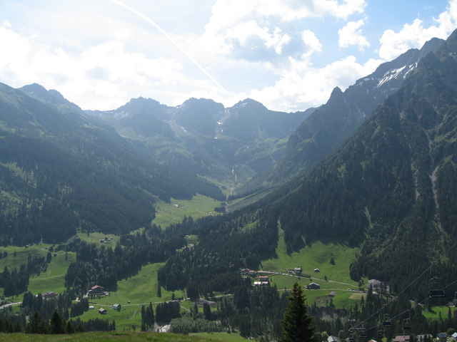
Die Tour startet in Hirschegg am Walserhaus und entspricht weitgehend der Tour 4 aus der Bike-Map die es kostenlos bei Kleinwalsertal Tourismus (www.kleinwalsertal.com) gibt. Der letzte Teil zur Bärgunthütte habe ich nicht gemacht. (Gewitter) Alternativ kann man den direkt an der Stutzalpe beginnenden Trail fahren. (Nur bei Trockenheit zu empfehlen) Der Trail mündet wieder auf der Route.

Further information at

http://www.walser-chalet.de/stutz_alpe/stutz_alpe.htm

Galeria trasy

Mapa trasy i profil wysokości

  • Open Street Map
  • Google
Minimum height 1124 m Maximum height 1505 m Widok szczegółowy

More about the tour author

Mallaga
Member since 2006

Send private message

Komentarze

GPS tracks

Trackpoints
  • GPX / Garmin Map Source (gpx) download
  • TCX / Garmin Training Center® (tcx) download
  • CRS / Garmin Training Center® (crs) download
  • Google Earth (kml) download
  • G7ToWin (g7t) download
  • TTQV (trk) download
  • Overlay (ovl) download
  • Fugawi (txt) download
  • Kompass (DAV) Track (tk) download
  • Karta trasy (pdf) download
  • Original file of the author (gpx) download

More about the tour author

Mallaga
Member since 2006

Send private message
Share track
Add to my favorites
Remove from my favorites
Edit tags
My score
Rate
Trasa: Zur Stutzalpe
Rodzaj: Rower górski (MTB)
Długość: 15,4 km
Evaluated on:
Czas trwania:
Day(s)
Hour(s)
Minute(s)
Ocena: Krajobraz Czynnik zadowolenia Kondycja Technika