Login

Zapomniałeś swój login?

Cookies have to be accepted!
Your browser's cookie functionality is disabled. Please enable this functionality.

Not a member yet?

Register now
Login

Available for registred users only

Log in to use this feature.

Zapomniałeś swój login?

Cookies have to be accepted!
Your browser's cookie functionality is disabled. Please enable this functionality.

Not a member yet?

Register now
Filter
Kategorie
Advanced filters
  • Długość (km)
  • Wysokość
Zapisz filtr Reset filter

TrackRank

QRCode

Technical data

Długość25,6 km Wysokość722 m Way down730 m Czas trwania02:00 h:m Data15.08.2011
Oceny Author Krajobraz Czynnik zadowolenia Kondycja Technika

Statystyka

1079 Widoki 1 Ocena 288 Downloads / Pliki do pobrania 4.00 Przeciętnie
Rate
  • Karta trasy
  • Dojazd
  • Downloads / Pliki do pobrania
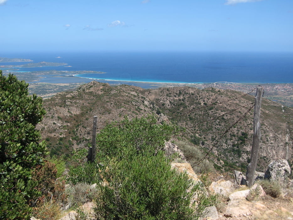
Von San Teodoro auf einer schönen Schotterstrasse, teilweise mit steilen Passagen, zum Aussichtsberg Vascone. Herrlicher Ausblick auf die Küste !!

Galeria trasy

Mapa trasy i profil wysokości

  • Open Street Map
  • Google
Minimum height 4 m Maximum height 615 m Widok szczegółowy

More about the tour author

Elias Laar
Member since 2006

Send private message

Komentarze

mschimme on 25.05.2018

Schöne Tour

Schöner kleiner Uphill contest ab San Teodoro. Viele steile Rampen, aber durchweg fahrbar. Fahrzeit 2h, 1h bis zum Abzweig Vascone, 1.20h bis zum Feuerwärterhaus. Sehr sonnenausgesetzt. Trotz Start um 7.00 Ende Mai schon mächtig geschwitzt. Keime besonderen technischen Herausforderungen. Schöne Landschaft
Beginn der Tour in San Teodoro.

GPS tracks

Trackpoints
  • GPX / Garmin Map Source (gpx) download
  • TCX / Garmin Training Center® (tcx) download
  • CRS / Garmin Training Center® (crs) download
  • Google Earth (kml) download
  • G7ToWin (g7t) download
  • TTQV (trk) download
  • Overlay (ovl) download
  • Fugawi (txt) download
  • Kompass (DAV) Track (tk) download
  • Karta trasy (pdf) download
  • Original file of the author (gpx) download

More about the tour author

Elias Laar
Member since 2006

Send private message
Share track
Add to my favorites
Remove from my favorites
Edit tags
My score
Rate
Trasa: Von San Teodoro zum Vascone
Rodzaj: Rower górski (MTB)
Długość: 25,6 km
Evaluated on:
Czas trwania:
Day(s)
Hour(s)
Minute(s)
Ocena: Krajobraz Czynnik zadowolenia Kondycja Technika