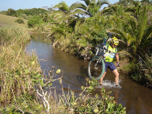
Anspruchsvolle Tour entlang der Wild Coast. Highlight ist die 'Jakaranda', ein altes Schiffswrack an einem einsamen Strand. Sehr technische Tour, viel Sand einige allerdings sehr leichte Flussdurchquerungen.
Es gibt keine Versorgung, alles mitbringen!!
Tour sollte mit einer grösseren Gruppe oder mit einem Guide durchgeführt werden.
** english **
Very technical Track along the Wild Coast. Highlight is the 'Jakaranda' a old ship wreck on a lonesome beach. Tracks are tricky with lots of sand and some easy river crossings. You have to be self sufficient, there is no shop!!
A guide is recommended (or at least a bigger group)
Further information at
http://www.manager-abenteuer.deGaleria trasy
Mapa trasy i profil wysokości
Minimum height -25 m
Maximum height 112 m
Komentarze
Startpunkt ist Kei Mouth (1 Autostunde von East London).
Dort gibt es noch eine gute Versorgung (Tankstelle, Restaurant..)
Dann geht es mit der Fähre über den Fluss, dort beginnt die unberührte Transkei.
Dort gibt es noch eine gute Versorgung (Tankstelle, Restaurant..)
Dann geht es mit der Fähre über den Fluss, dort beginnt die unberührte Transkei.
GPS tracks
Trackpoints-
GPX / Garmin Map Source (gpx) download
-
TCX / Garmin Training Center® (tcx) download
-
CRS / Garmin Training Center® (crs) download
-
Google Earth (kml) download
-
G7ToWin (g7t) download
-
TTQV (trk) download
-
Overlay (ovl) download
-
Fugawi (txt) download
-
Kompass (DAV) Track (tk) download
-
Karta trasy (pdf) download
-
Original file of the author (gpx) download
Add to my favorites
Remove from my favorites
Edit tags
Open track
My score
Rate


Highlight der Tour