

Wie alle meine Touren, Asphaltvermeidung wo geht und sinnvoll erscheint
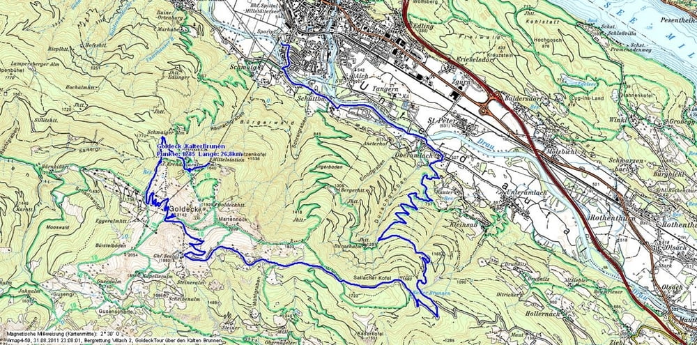
Die Tour beginnt bei der Goldeckbahn - Mittelstation (Dorf Goldeck) und führt über bekannte Wege hinauf zum Sender + Gipfelkreuz.
Von dort gehts über das Seetal zur Mautstraße und weiter zum "Kalten Brunnen". Dort beginnt die interessante Abfahrt über div. Forstwege vorbei an der Durachalm nach Oberamlach, immer mit herrlichen Blicken nach Spittal, Liesertal, Wolfsberg, Millstättersee und vieles mehr..
Eine kurze Strecke (rd. 100m) im Bereich kalter Brunnen ist das Bike über einen verlassenen (und fast nicht mehr sichtbaren) Steig zur darunterliegenden Forststraße (2x) zu tragen; dies stellt keine weiteren Probleme dar. Ansonsten ist die Tour durchwegs fahrbar, und empfehlenswert.
Galeria trasy

Mapa trasy i profil wysokości
Minimum height 548 m
Maximum height 2135 m
More about the tour author
|
|
johnatan |
Komentarze

Talstation Goldeck - Gondel Bergbahnen / Spittal an der Drau.
GPS tracks
Trackpoints-
GPX / Garmin Map Source (gpx) download
-
TCX / Garmin Training Center® (tcx) download
-
CRS / Garmin Training Center® (crs) download
-
Google Earth (kml) download
-
G7ToWin (g7t) download
-
TTQV (trk) download
-
Overlay (ovl) download
-
Fugawi (txt) download
-
Kompass (DAV) Track (tk) download
-
Karta trasy (pdf) download
-
Original file of the author (gpx) download
More about the tour author
|
|
johnatan |
Add to my favorites
Remove from my favorites
Edit tags
Open track
My score
Rate