

Nachdem in der Roadbike die Tour von Pforzheim aus beschrieben wurde, habe ich diese abgwandelt mit Start und Ziel in Calw.
Leider war schlechtes Wetter und die Höhn bin ich im Nebel gefahren. Von daher kann ich nichts zur Aussicht sagen.
Tour ist sicherlich anspruchsvoll aber vom Verkehr gut zu fahren - da viel über kleine Landesstrassen gefahren wird.
roland ehry (july 2007)
Leider war schlechtes Wetter und die Höhn bin ich im Nebel gefahren. Von daher kann ich nichts zur Aussicht sagen.
Tour ist sicherlich anspruchsvoll aber vom Verkehr gut zu fahren - da viel über kleine Landesstrassen gefahren wird.
roland ehry (july 2007)
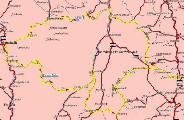
Mapa trasy i profil wysokości
Minimum height 331 m
Maximum height 905 m
More about the tour author

|
scott_99 |
Komentarze
GPS tracks
Trackpoints-
GPX / Garmin Map Source (gpx) download
-
TCX / Garmin Training Center® (tcx) download
-
CRS / Garmin Training Center® (crs) download
-
Google Earth (kml) download
-
G7ToWin (g7t) download
-
TTQV (trk) download
-
Overlay (ovl) download
-
Fugawi (txt) download
-
Kompass (DAV) Track (tk) download
-
Karta trasy (pdf) download
-
Original file of the author (gpx) download
More about the tour author
|
|
scott_99 |
Add to my favorites
Remove from my favorites
Edit tags
Open track
My score
Rate
Auf relativ kurzer Distanz ganz ordentlich Hm, gute Vorbereitung für Radmarathons.