Login

Zapomniałeś swój login?

Cookies have to be accepted!
Your browser's cookie functionality is disabled. Please enable this functionality.

Not a member yet?

Register now
Login

Available for registred users only

Log in to use this feature.

Zapomniałeś swój login?

Cookies have to be accepted!
Your browser's cookie functionality is disabled. Please enable this functionality.

Not a member yet?

Register now
Filter
Kategorie
Advanced filters
  • Długość (km)
  • Wysokość
Zapisz filtr Reset filter

TrackRank

QRCode

Technical data

Długość91,4 km Wysokość545 m Way down447 m Czas trwania04:45 h:m Data24.09.2011
Oceny Author Krajobraz Czynnik zadowolenia Kondycja Technika

Statystyka

525 Widoki Oceny 13 Downloads / Pliki do pobrania Przeciętnie
Rate
  • Karta trasy
  • Dojazd
  • Downloads / Pliki do pobrania

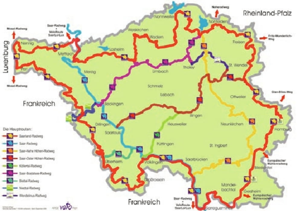
Tag 3 der Rundfahrt.

Von SB geht es an der Saar entlang richtung Saargemuines. Dort wechsel zur Blies, dann Richtung Blieskastel, Homburg.

Ab dort kommt die lange Anfahrt zum Höchenberg.

Durchs Ostertal nach Werschweiler.


Mapa trasy i profil wysokości

  • Open Street Map
  • Google
Minimum height 182 m Maximum height 519 m Widok szczegółowy

More about the tour author

bike82
Member since 2011

Send private message

Komentarze

GPS tracks

Trackpoints
  • GPX / Garmin Map Source (gpx) download
  • TCX / Garmin Training Center® (tcx) download
  • CRS / Garmin Training Center® (crs) download
  • Google Earth (kml) download
  • G7ToWin (g7t) download
  • TTQV (trk) download
  • Overlay (ovl) download
  • Fugawi (txt) download
  • Kompass (DAV) Track (tk) download
  • Karta trasy (pdf) download
  • Original file of the author (gpx) download

More about the tour author

bike82
Member since 2011

Send private message
Share track
Add to my favorites
Remove from my favorites
Edit tags
My score
Rate
Trasa: Saarland Rundfahrt Tag 3
Rodzaj: Rower górski (MTB)
Długość: 91,4 km
Evaluated on:
Czas trwania:
Day(s)
Hour(s)
Minute(s)
Ocena: Krajobraz Czynnik zadowolenia Kondycja Technika