Login

Zapomniałeś swój login?

Cookies have to be accepted!
Your browser's cookie functionality is disabled. Please enable this functionality.

Not a member yet?

Register now
Login

Available for registred users only

Log in to use this feature.

Zapomniałeś swój login?

Cookies have to be accepted!
Your browser's cookie functionality is disabled. Please enable this functionality.

Not a member yet?

Register now
Filter
Kategorie
Advanced filters
  • Długość (km)
  • Wysokość
Zapisz filtr Reset filter

TrackRank

QRCode

Technical data

Długość22,9 km Wysokość596 m Way down589 m Czas trwania02:15 h:m Data03.10.2011
Oceny Author Krajobraz Czynnik zadowolenia Kondycja Technika

Statystyka

835 Widoki Oceny 127 Downloads / Pliki do pobrania Przeciętnie
Rate
  • Karta trasy
  • Dojazd
  • Downloads / Pliki do pobrania

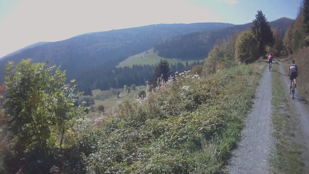
Familienfreundliche Tour, da ohne besondere Singletrails ... bis auf das Stück am Hochkopf, aber hier kann man auch den offiziellen Weg fahren zum Aussichtsturm.

Phantastische Aussicht!

Galeria trasy

Mapa trasy i profil wysokości

  • Open Street Map
  • Google
Minimum height 875 m Maximum height 1258 m Widok szczegółowy

More about the tour author

kiri
Member since 2011

Send private message

Komentarze

Mit Auto nach Bernau im Schwarzwald, vor dem Rathaus parken und losfahren!

Den besten Kuchen gibt es dann auch gleich gegenüber vom Rathaus!

GPS tracks

Trackpoints
  • GPX / Garmin Map Source (gpx) download
  • TCX / Garmin Training Center® (tcx) download
  • CRS / Garmin Training Center® (crs) download
  • Google Earth (kml) download
  • G7ToWin (g7t) download
  • TTQV (trk) download
  • Overlay (ovl) download
  • Fugawi (txt) download
  • Kompass (DAV) Track (tk) download
  • Karta trasy (pdf) download
  • Original file of the author (gpx) download

More about the tour author

kiri
Member since 2011

Send private message
Share track
Add to my favorites
Remove from my favorites
Edit tags
My score
Rate
Trasa: Bernau/Schwarzwald Hochkopf Tour (Video) mit phantastischer Aussicht
Rodzaj: Rower górski (MTB)
Długość: 22,9 km
Evaluated on:
Czas trwania:
Day(s)
Hour(s)
Minute(s)
Ocena: Krajobraz Czynnik zadowolenia Kondycja Technika