


Dies ist bei meiner kleinen Karwendeltour die 3. Etappe; 1./2. Etappe siehe Tour 91335/ 91336
Gleich nach dem Gasthaus links ab "Abkürzung Binsalm". Es geht mäßig steil bis auf einen Fahrweg, auf diesem bis zur Binsalm. Rechts weiter und gleich links auf Wiesenpfad aufwärts, links auf Fahrweg und bald wieder auf Pfad aufwärts.Dann geht es bis kurz vor dem Binsjoch wieder auf Fahrweg und ab hier auf Bergweg zur Lamsenjoch- Hütte.
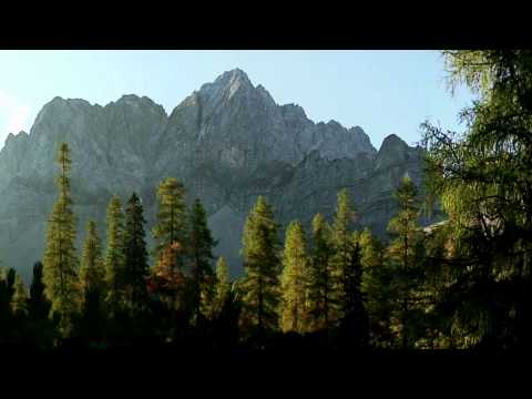
Wir gehen ein Stück des Weges zurück und nach rechts über Serpentinen ins Falzturntal. Ab der Grammai- Alm geht es gemütlich über die Falzturn- Alm zum Parkplatz (vom 1.Tag) in Pertisau.
Galeria trasy

Mapa trasy i profil wysokości
Minimum height 967 m
Maximum height 1947 m
More about the tour author
|
|
heinz-57 |
Komentarze

Google Earth: 47.402257° / 11.567297°
Wanderung: von Pertisau, siehe Tour 91335.
Ansonsten: von Lenggries oder dem Achensee kommend zum Syvenstein- Stausee und Hinterriß in die "Eng"
GPS tracks
Trackpoints-
GPX / Garmin Map Source (gpx) download
-
TCX / Garmin Training Center® (tcx) download
-
CRS / Garmin Training Center® (crs) download
-
Google Earth (kml) download
-
G7ToWin (g7t) download
-
TTQV (trk) download
-
Overlay (ovl) download
-
Fugawi (txt) download
-
Kompass (DAV) Track (tk) download
-
Karta trasy (pdf) download
-
Original file of the author (gpx) download
More about the tour author
|
|
heinz-57 |
Add to my favorites
Remove from my favorites
Edit tags
Open track
My score
Rate