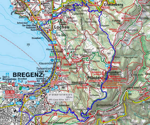
Ueber die Rodelbahn zum Pfänder. Abfahrt über Eichenberg nach Lochau und zurück nach Dornbirn. Beim Abbiegen von der Hauptstrasse in Eichenberg etwas schwieriges Teilstück. Vorsicht !!.
ca. 700 Höhenmeter.
ca. 700 Höhenmeter.
Further information at
http://klauserg.dyndns.org/1701_12_1_index_sport_bike_tour12.phpGaleria trasy
Mapa trasy i profil wysokości
Minimum height 393 m
Maximum height 1015 m
Komentarze

Pfändersprint
GPS tracks
Trackpoints-
GPX / Garmin Map Source (gpx) download
-
TCX / Garmin Training Center® (tcx) download
-
CRS / Garmin Training Center® (crs) download
-
Google Earth (kml) download
-
G7ToWin (g7t) download
-
TTQV (trk) download
-
Overlay (ovl) download
-
Fugawi (txt) download
-
Kompass (DAV) Track (tk) download
-
Karta trasy (pdf) download
-
Original file of the author (gpx) download
Add to my favorites
Remove from my favorites
Edit tags
Open track
My score
Rate


