


Kleine Rundwanderung an der Havel.
Die Gegend zwischen der Pfaueninsel und der Moorlake eignet sich prima für eine kleine Wanderung bei trübem Wetter.
Es gibt einiges für das Auge.
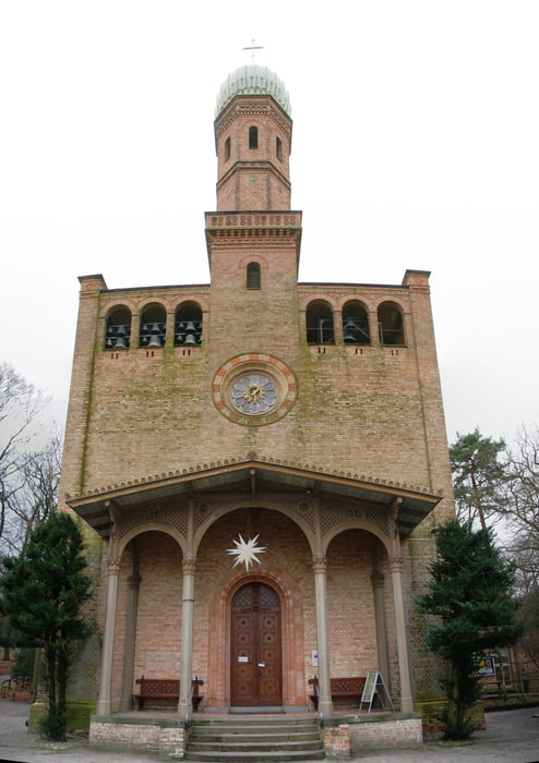
+ Die Kirche Peter und Paul Nikolskoe schaut russisch aus ist aber eine evangelische Kirche.
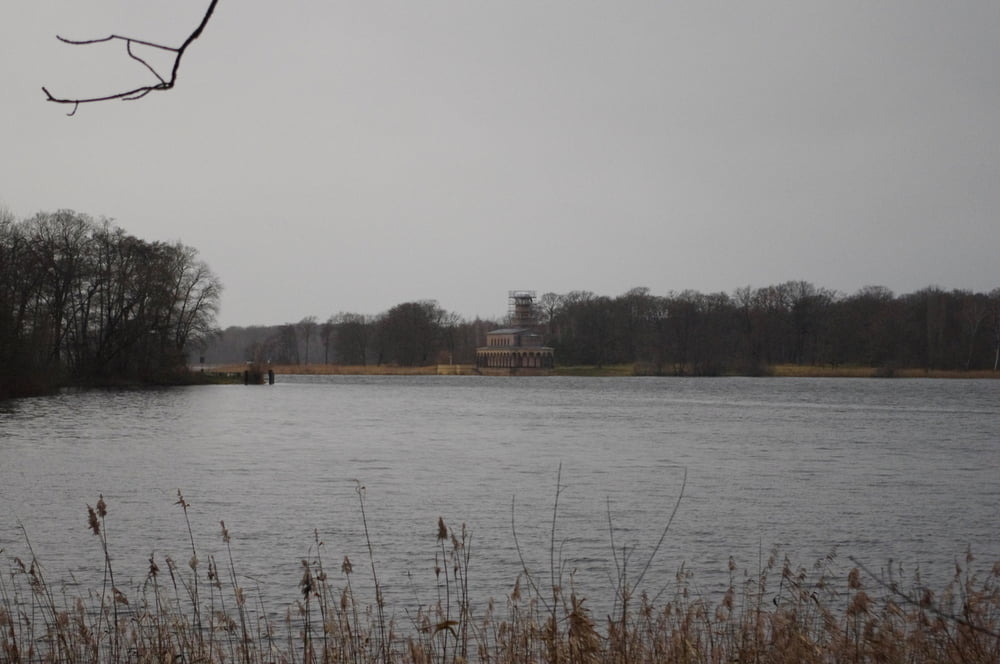
+ Ausblicke auf die Pfaueninsel und rüber zur Heilandskirche bei Sacrow.
Wer sich ruhig verhält kann auch mal ein paar Wildschweinen begegnen. Meistens sind Diese aber eher versteckt und lassen sich nicht sehen.
Geniessen Sie die Landschaft.
Further information at
http://www.umweltkalender-berlin.de/anbieter/details/1224Galeria trasy


Mapa trasy i profil wysokości
Minimum height 29 m
Maximum height 61 m
More about the tour author
|
|
Pheinz |
Komentarze

Vom letzten Parkplatz vor der Pfaueninsel geht es los.
GPS tracks
Trackpoints-
GPX / Garmin Map Source (gpx) download
-
TCX / Garmin Training Center® (tcx) download
-
CRS / Garmin Training Center® (crs) download
-
Google Earth (kml) download
-
G7ToWin (g7t) download
-
TTQV (trk) download
-
Overlay (ovl) download
-
Fugawi (txt) download
-
Kompass (DAV) Track (tk) download
-
Karta trasy (pdf) download
-
Original file of the author (gpx) download
More about the tour author
|
|
Pheinz |
Add to my favorites
Remove from my favorites
Edit tags
Open track
My score
Rate