Login

Zapomniałeś swój login?

Cookies have to be accepted!
Your browser's cookie functionality is disabled. Please enable this functionality.

Not a member yet?

Register now
Login

Available for registred users only

Log in to use this feature.

Zapomniałeś swój login?

Cookies have to be accepted!
Your browser's cookie functionality is disabled. Please enable this functionality.

Not a member yet?

Register now
Filter
Kategorie
Advanced filters
  • Długość (km)
  • Wysokość
Zapisz filtr Reset filter

TrackRank

QRCode

Technical data

Długość4,4 km Wysokość10 m Way down36 m Czas trwania00:55 h:m Data28.03.2012
Oceny Author Krajobraz Czynnik zadowolenia Kondycja Technika

Statystyka

311 Widoki Oceny 15 Downloads / Pliki do pobrania Przeciętnie
Rate
  • Karta trasy
  • Dojazd
  • Downloads / Pliki do pobrania

Wieder einmal eine kleine Feierabendrunde.
Diesmal bei Semlin in Rathenow.

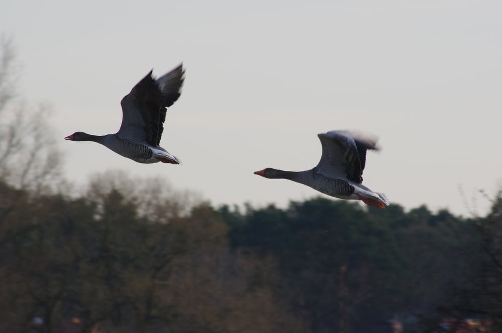
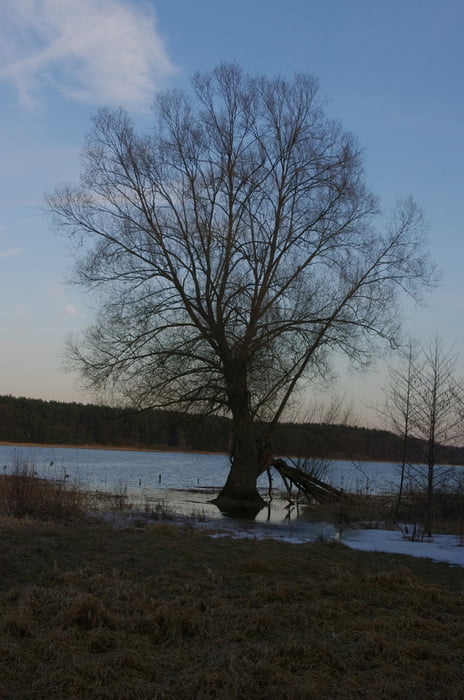
Eigentlich wollte ich am Ufer der Havel entlangwandern aber das viele Wasser hat mich immer wieder abgedrängt. Ein Weg war nicht immer begehbar so wendete ich irgendwann um auf dem Gehweg zurück zum Antik Hotel zu gehen.

Den Abschluß bildete die kleine Kirche in Semlin.

Further information at

http://de.wikipedia.org/wiki/Havel

Galeria trasy

Mapa trasy i profil wysokości

  • Open Street Map
  • Google
Minimum height 16 m Maximum height 42 m Widok szczegółowy

More about the tour author

Pheinz
Member since 2009

Send private message

Komentarze

GPS tracks

Trackpoints
  • GPX / Garmin Map Source (gpx) download
  • TCX / Garmin Training Center® (tcx) download
  • CRS / Garmin Training Center® (crs) download
  • Google Earth (kml) download
  • G7ToWin (g7t) download
  • TTQV (trk) download
  • Overlay (ovl) download
  • Fugawi (txt) download
  • Kompass (DAV) Track (tk) download
  • Karta trasy (pdf) download
  • Original file of the author (gpx) download

More about the tour author

Pheinz
Member since 2009

Send private message
Share track
Add to my favorites
Remove from my favorites
Edit tags
My score
Rate
Trasa: Havelhochwasser bei Semlin
Rodzaj: Wędrówki
Długość: 4,4 km
Evaluated on:
Czas trwania:
Day(s)
Hour(s)
Minute(s)
Ocena: Krajobraz Czynnik zadowolenia Kondycja Technika