


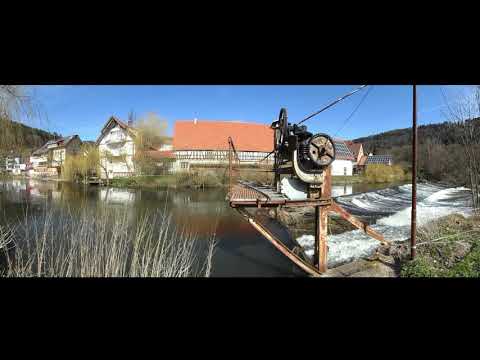
Canadiertour auf der Nagold im nördlichen Schwarzwald bei einem Pegel in Calw von 81 cm.
Ich paddelte den Fluss wie im letzten Jahr solo im Canadier bei wunderschönem Frühlingswetter. Die Tour erinnerte mich an die auf der Sinn im Spessart, sowohl landschaftlich als auch vom Schwierigkeitsgrad her (Wildwasser I). Ein ständiger Wechsel von Wiesen und Wäldern in flotter Strömung. Die Wehre konnte ich problemlos und einfach umtragen.
Unter einem Pegel in Calw von 75 cm ist das Paddeln auf der Nagold verboten. Richtig Spaß soll der Fluss ab einem Pegel von 85 cm machen. Den aktuellen Pegel kann man neben der Internetseite der Hochwasserzentrale auch jederzeit unter der Telefonnummer 07051-30368 abrufen.
Befahrungsregeln Nagold Pegel Calw
Further information at
http://de.wikipedia.org/wiki/Nagold_(Fluss)Galeria trasy


Mapa trasy i profil wysokości
Minimum height 260 m
Maximum height 318 m
More about the tour author
|
|
riemchens |
Komentarze

über die A8 durch Pforzheim Richtung Calw. Links ab ins Monbachtal. Hier findet man direkt am Wehr Monbachtal eine gute offizielle Einstiegstelle und auch eine Parkmöglichkeit für das Auto. Auf einem Schild wird man auf die Mindestpegelstände für die Befahrung hingewiesen. Hier findet man auch nocheinmal die Telefonnumer zum Abruf des aktuellen Pegelstandes.
GPS tracks
Trackpoints-
GPX / Garmin Map Source (gpx) download
-
TCX / Garmin Training Center® (tcx) download
-
CRS / Garmin Training Center® (crs) download
-
Google Earth (kml) download
-
G7ToWin (g7t) download
-
TTQV (trk) download
-
Overlay (ovl) download
-
Fugawi (txt) download
-
Kompass (DAV) Track (tk) download
-
Karta trasy (pdf) download
-
Original file of the author (gpx) download
More about the tour author
|
|
riemchens |
Add to my favorites
Remove from my favorites
Edit tags
Open track
My score
Rate