

Dies ist eine grob, nach offiziellen Radwegen geplante Route mit ungefähr 100 km pro Tag. Die Tour führt durch Gegendend mit leichten bis mittleren Steigungen.
Los geht's in Leipzig und Übernachtungspunkte sind in Jena, Lengenfeld und Rabenstein bei Chemnitz (ca. 10 km von der Innenstadt entfernt).
Streckenplan nach Radwegenetz:
Elsterradweg - Thüringer Mühlenradweg - Jena - zurück zur Elster - Göltzschtalradweg - dann nach Zwickau - Muldenradweg - Mittellandroute D4 - Radweit Chemnitz-Leipzig
Die wirklich gefahrene Strecke wird im August aktualisiert.
Über Erfahrungen mit der Strecke / Verbesserungsvorschläge freuen wir uns sehr.
Galeria trasy


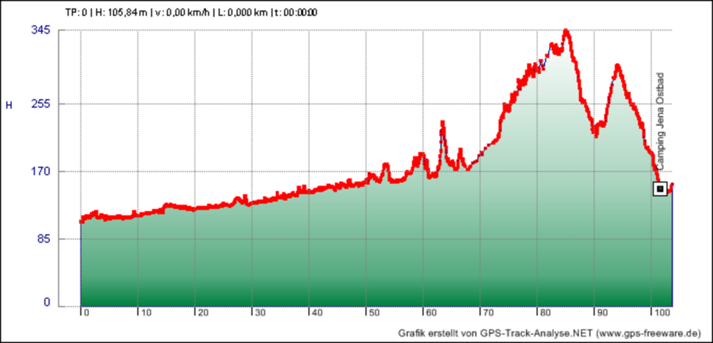
Mapa trasy i profil wysokości
Minimum height 105 m
Maximum height 490 m
More about the tour author

|
nicok |
Komentarze

GPS tracks
Trackpoints-
GPX / Garmin Map Source (gpx) download
-
TCX / Garmin Training Center® (tcx) download
-
CRS / Garmin Training Center® (crs) download
-
Google Earth (kml) download
-
G7ToWin (g7t) download
-
TTQV (trk) download
-
Overlay (ovl) download
-
Fugawi (txt) download
-
Kompass (DAV) Track (tk) download
-
Karta trasy (pdf) download
-
Original file of the author (gpx) download
More about the tour author
|
|
nicok |
Add to my favorites
Remove from my favorites
Edit tags
Open track
My score
Rate