
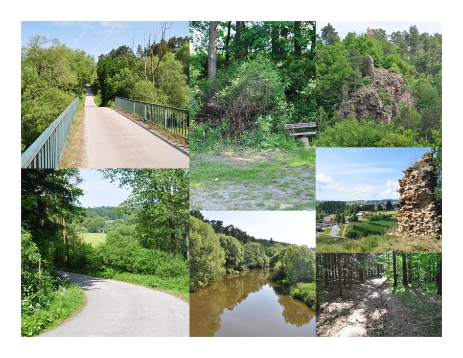

Von der Liebnitzmühle folgt man der sehr guten Beschilderung ein Stück auf der Straße zur Brücke über die Thaya. Nach der Brücke zweigt der Wanderweg rechts in den Wald und steigt stetig an bis zur Ebene oberhalb der Thaya. Ein Stück noch am Feld entlang und man steht vor dem ehemaligen Burgtor und überlegt sich wie diese Burg wohl ausgesehen haben mag. Zugegeben ist von der Burg nichts Wesentliches mehr zu sehen, doch die Aussicht hinab auf die Liebnitzmühle ist sehr schön und lädt zum Verweilen ein.
Zemljevid in višinski profil izleta
Minimum height 398 m
Maximum height 471 m
More about the tour author
|
|
huberj59 |
Komentarji

Start und Ende der Wanderung ist das Hotel und Restaurant Liebnitzmühle.
Poti GPS
Trackpoints-
GPX / Garmin Map Source (gpx) download
-
TCX / Garmin Training Center® (tcx) download
-
CRS / Garmin Training Center® (crs) download
-
Google Earth (kml) download
-
G7ToWin (g7t) download
-
TTQV (trk) download
-
Overlay (ovl) download
-
Fugawi (txt) download
-
Kompass (DAV) Track (tk) download
-
List z izleti (pdf) download
-
Original file of the author (gpx) download
More about the tour author
|
|
huberj59 |
Add to my favorites
Remove from my favorites
Edit tags
Open track
My score
Rate