Login

Si pozabil/a podatke za prijavo?

Cookies have to be accepted!
Your browser's cookie functionality is disabled. Please enable this functionality.

Not a member yet?

Register now
Login

Available for registred users only

Log in to use this feature.

Si pozabil/a podatke za prijavo?

Cookies have to be accepted!
Your browser's cookie functionality is disabled. Please enable this functionality.

Not a member yet?

Register now
Filter
Kategorije
Advanced filters
  • Dolžina (km)
  • Metri nadmorske višine
Shrani filter Reset filter

TrackRank

QRCode

Technical data

Dolžina47,4 km Metri nadmorske višine712 m Way down723 m Trajanje03:30 h:m Datum06.08.2012
Ocene Author Pokrajina Dejavnik zabave Kondicija Tehnika

Statistika

637 Pogledi Ocene 28 Prenosi Povprečje
Rate
  • List z izleti
  • Prihod
  • Prenosi

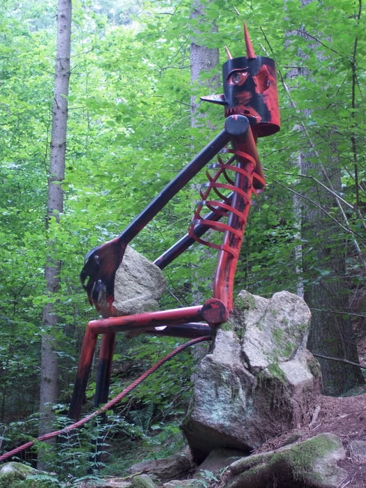
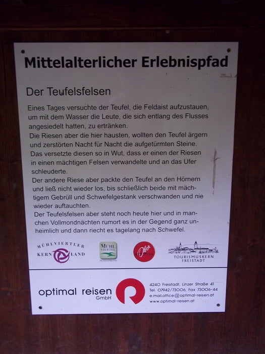
Schöne Tour entlang des Pferdeeisenbahnweges bis Kerschbaum. Weiter über Nordwaldkammweg zum Opferstein und weiter auf den Reisingerberg (tlw. Schiebestrecke) und über den Waldlehrpfad zum Gasthaus Waldlehrpfad. Nach der Mittagsrast über Oberpaßberg und das wunderschöne Thurytal zurück nach Freistadt.

(kürzere Variante als die Tour: Rund um Freistadt)

Galerija izletov

Zemljevid in višinski profil izleta

  • Open Street Map
  • Google
Minimum height 545 m Maximum height 847 m Prikaz podrobnosti

More about the tour author

Rammre
Member since 2012

Send private message

Komentarji

Startpunkt in Freistadt beim Bahnhof

Poti GPS

Trackpoints
  • GPX / Garmin Map Source (gpx) download
  • TCX / Garmin Training Center® (tcx) download
  • CRS / Garmin Training Center® (crs) download
  • Google Earth (kml) download
  • G7ToWin (g7t) download
  • TTQV (trk) download
  • Overlay (ovl) download
  • Fugawi (txt) download
  • Kompass (DAV) Track (tk) download
  • List z izleti (pdf) download
  • Original file of the author (gpx) download

More about the tour author

Rammre
Member since 2012

Send private message
Share track
Add to my favorites
Remove from my favorites
Edit tags
My score
Rate
Izlet: Pferdeeisenbahnweg, Thurytal
Vrsta: Gorsko kolo
Dolžina: 47,4 km
Evaluated on:
Trajanje:
Day(s)
Hour(s)
Minute(s)
Ocena: Pokrajina Dejavnik zabave Kondicija Tehnika