Login

Si pozabil/a podatke za prijavo?

Cookies have to be accepted!
Your browser's cookie functionality is disabled. Please enable this functionality.

Not a member yet?

Register now
Login

Available for registred users only

Log in to use this feature.

Si pozabil/a podatke za prijavo?

Cookies have to be accepted!
Your browser's cookie functionality is disabled. Please enable this functionality.

Not a member yet?

Register now
Filter
Kategorije
Advanced filters
  • Dolžina (km)
  • Metri nadmorske višine
Shrani filter Reset filter

TrackRank

QRCode

Technical data

Dolžina76,0 km Metri nadmorske višine2335 m Way down1603 m Trajanje05:50 h:m Datum28.09.2012
Ocene Author Pokrajina Dejavnik zabave Kondicija Tehnika

Statistika

766 Pogledi Ocene 78 Prenosi Povprečje
Rate
  • List z izleti
  • Prihod
  • Prenosi

Innsbruck-Weer-Innerst-Weidener Hütte-Geiseljoch-
Vorderlahnersbach-Finkenberg-Ginzling-Breitlahner

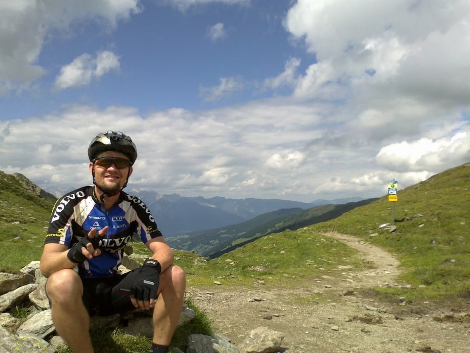
Herrlicher Übergang übers Geiseljoch, praktisch alles fahrbar!
Lässige, einfache Unterkunft im Breitlahner.
 

Galerija izletov

Zemljevid in višinski profil izleta

  • Open Street Map
  • Google
Minimum height 549 m Maximum height 2285 m Prikaz podrobnosti

More about the tour author

mitter
Member since 2008

Send private message

Komentarji

Start in Innsbruck Wilten.

Poti GPS

Trackpoints
  • GPX / Garmin Map Source (gpx) download
  • TCX / Garmin Training Center® (tcx) download
  • CRS / Garmin Training Center® (crs) download
  • Google Earth (kml) download
  • G7ToWin (g7t) download
  • TTQV (trk) download
  • Overlay (ovl) download
  • Fugawi (txt) download
  • Kompass (DAV) Track (tk) download
  • List z izleti (pdf) download
  • Original file of the author (gpx) download

More about the tour author

mitter
Member since 2008

Send private message
Share track
Add to my favorites
Remove from my favorites
Edit tags
My score
Rate
Izlet: Geiseljoch
Vrsta: Gorsko kolo
Dolžina: 76,0 km
Evaluated on:
Trajanje:
Day(s)
Hour(s)
Minute(s)
Ocena: Pokrajina Dejavnik zabave Kondicija Tehnika