

Tour startete in Santa Lucia am Camping Selema
Wir folgten der Straße Richtung Orosei und nach ca. 6 km rechts Richtung Irgoli, Galtelli.
Ausschl. auf Straße, daher ist ein Mountainbike nicht erforderlich (auch mit Rennrad machbar).
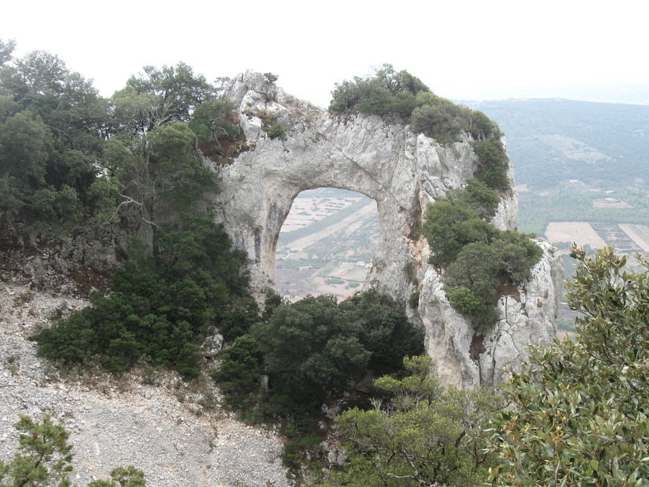
Unsere Tour endete an dem Felstor Petra Istampada oberhalb von Galtelli.
Weitere ca. 250 hm (?) sind notwnendig, dann kommt man kurz unterhalb des Gipfels Monte Tuttavista heraus.
Aufgrund der fortgeschrittenen Zeit haben wir dies ausgelassen.
Die Aussicht vom Gipfel soll gradios sein!?!
Die Tour ist sicherlich kein Hochgenuss, wer Lust auf Sport hat und auf möglichst verkehrsarmen Straßen unterwegs sein möchte, wird trotzdem Spass haben.
Wir folgten der Straße Richtung Orosei und nach ca. 6 km rechts Richtung Irgoli, Galtelli.
Ausschl. auf Straße, daher ist ein Mountainbike nicht erforderlich (auch mit Rennrad machbar).
Unsere Tour endete an dem Felstor Petra Istampada oberhalb von Galtelli.
Weitere ca. 250 hm (?) sind notwnendig, dann kommt man kurz unterhalb des Gipfels Monte Tuttavista heraus.
Aufgrund der fortgeschrittenen Zeit haben wir dies ausgelassen.
Die Aussicht vom Gipfel soll gradios sein!?!
Die Tour ist sicherlich kein Hochgenuss, wer Lust auf Sport hat und auf möglichst verkehrsarmen Straßen unterwegs sein möchte, wird trotzdem Spass haben.
Galerija izletov

Zemljevid in višinski profil izleta
Minimum height 8 m
Maximum height 567 m
More about the tour author
|
|
Vogge |
Komentarji

Poti GPS
Trackpoints-
GPX / Garmin Map Source (gpx) download
-
TCX / Garmin Training Center® (tcx) download
-
CRS / Garmin Training Center® (crs) download
-
Google Earth (kml) download
-
G7ToWin (g7t) download
-
TTQV (trk) download
-
Overlay (ovl) download
-
Fugawi (txt) download
-
Kompass (DAV) Track (tk) download
-
List z izleti (pdf) download
-
Original file of the author (gpx) download
More about the tour author
|
|
Vogge |
Add to my favorites
Remove from my favorites
Edit tags
Open track
My score
Rate