
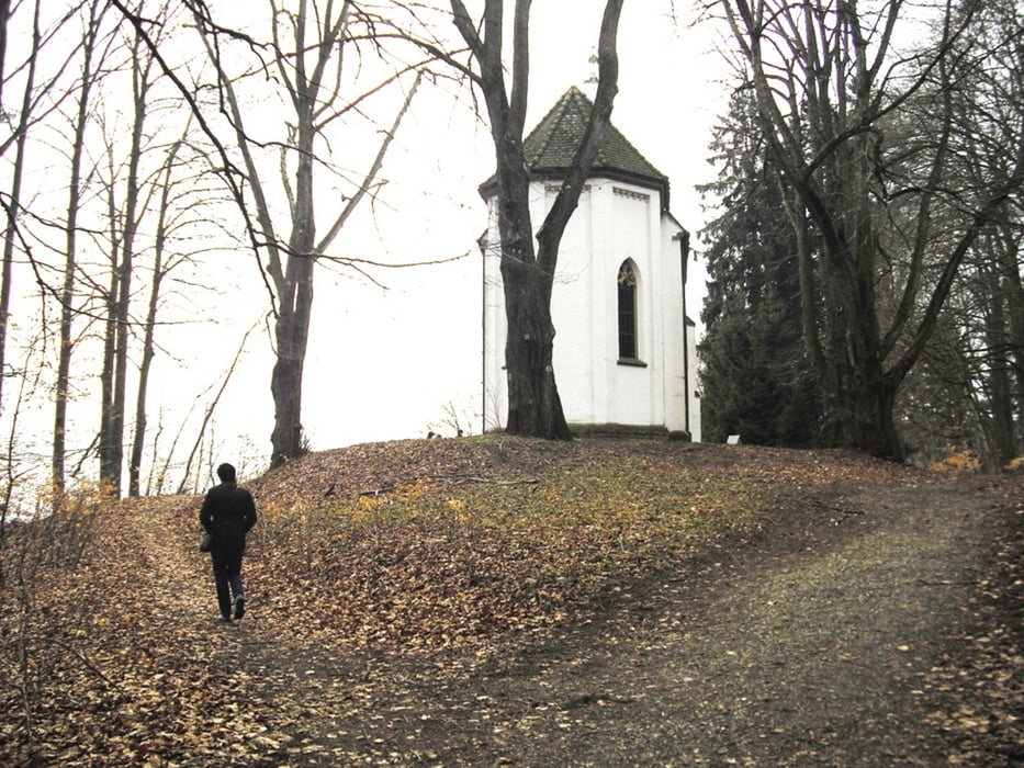

Kleine Frühjahrswanderung bei Bad Schussenried. Wir starten in Otterswang nähe Kirche und gehen bergwärts durch den Atzenberger Tobel. Durch den Bergwald kommen wir zur Kapelle Hohkreuz. Hier gibts eine schöne Rast und einen Ausblick über das gesamte Schussental. Weiter gehts nun zum Auwald und durch den Burgtobel entlang einem kleinen Bächlein zum Burg-Cafe. Hier gibts eine schöne Aussicht auf das Schussental mit Einkehrmöglichkeit und Gartenwirtschaft im Sommer.
www.burgcafe-otterswang.de
Further information at
http://www.bad-schussenried.deGalerija izletov


Zemljevid in višinski profil izleta
Minimum height 522 m
Maximum height 671 m
More about the tour author
|
|
Bockrider |
Komentarji

Otterswang liegt an der L284 zwischen Aulendorf und Bad Schussenried. Parken z.B. bei der Kirche nähe Hauptstrasse.
Poti GPS
Trackpoints-
GPX / Garmin Map Source (gpx) download
-
TCX / Garmin Training Center® (tcx) download
-
CRS / Garmin Training Center® (crs) download
-
Google Earth (kml) download
-
G7ToWin (g7t) download
-
TTQV (trk) download
-
Overlay (ovl) download
-
Fugawi (txt) download
-
Kompass (DAV) Track (tk) download
-
List z izleti (pdf) download
-
Original file of the author (gpx) download
More about the tour author
|
|
Bockrider |
Add to my favorites
Remove from my favorites
Edit tags
Open track
My score
Rate