Login

Si pozabil/a podatke za prijavo?

Cookies have to be accepted!
Your browser's cookie functionality is disabled. Please enable this functionality.

Not a member yet?

Register now
Login

Available for registred users only

Log in to use this feature.

Si pozabil/a podatke za prijavo?

Cookies have to be accepted!
Your browser's cookie functionality is disabled. Please enable this functionality.

Not a member yet?

Register now
Filter
Kategorije
Advanced filters
  • Dolžina (km)
  • Metri nadmorske višine
Shrani filter Reset filter

TrackRank

QRCode

Technical data

Dolžina19,4 km Metri nadmorske višine1160 m Way down1161 m Trajanje04:00 h:m Datum26.04.2013
Ocene Author Pokrajina Dejavnik zabave Kondicija Tehnika

Statistika

1053 Pogledi Ocene 20 Prenosi Povprečje
Rate
  • List z izleti
  • Prihod
  • Prenosi

Man kann den Bergmönch auch abwärts tragen

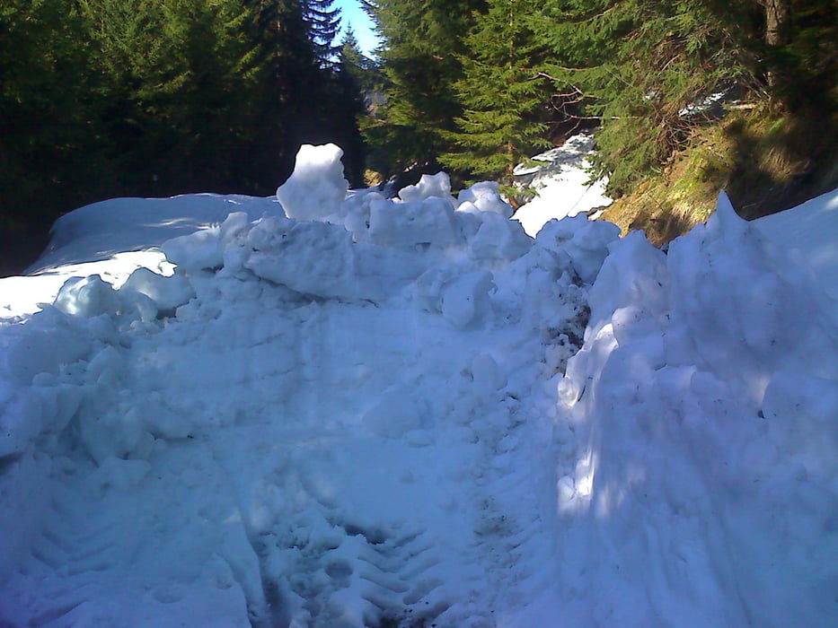
Die Stecke zwischen Schönermanalpe und Schuttannen war am 25.4.2013 noch im tiefen Winterschlaf.


Der GPS Empfang zwischen 5,5 und 6,7 km war eher bescheiden.

Galerija izletov

Zemljevid in višinski profil izleta

  • Open Street Map
  • Google
Minimum height 425 m Maximum height 1420 m Prikaz podrobnosti

More about the tour author

xlink
Member since 2010

Send private message

Komentarji

Poti GPS

Trackpoints
  • GPX / Garmin Map Source (gpx) download
  • TCX / Garmin Training Center® (tcx) download
  • CRS / Garmin Training Center® (crs) download
  • Google Earth (kml) download
  • G7ToWin (g7t) download
  • TTQV (trk) download
  • Overlay (ovl) download
  • Fugawi (txt) download
  • Kompass (DAV) Track (tk) download
  • List z izleti (pdf) download
  • Original file of the author (gpx) download

More about the tour author

xlink
Member since 2010

Send private message
Share track
Add to my favorites
Remove from my favorites
Edit tags
My score
Rate
Izlet: Hohenems - Gsohlalpe - Schönermannalpe - Schuttannen
Vrsta: Pešačenje
Dolžina: 19,4 km
Evaluated on:
Trajanje:
Day(s)
Hour(s)
Minute(s)
Ocena: Pokrajina Dejavnik zabave Kondicija Tehnika