


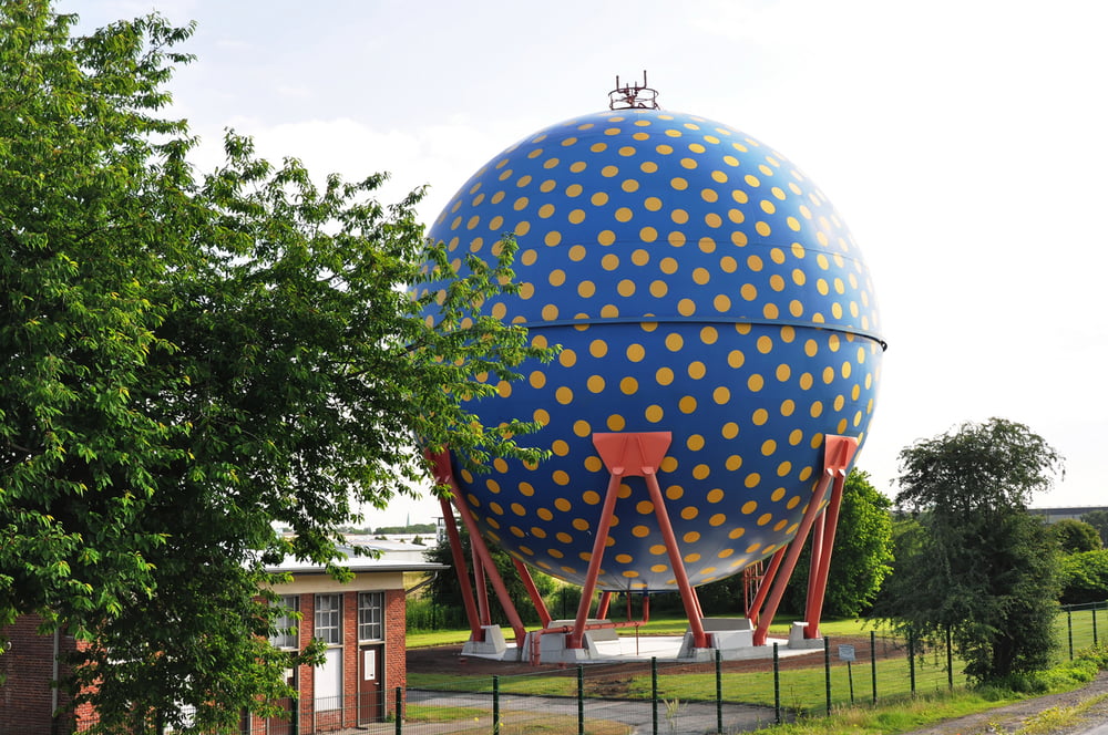
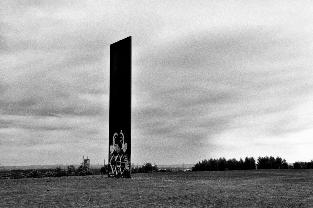
Von Recklinghausen aus Richtung Süden zur Halde Hoheward (Herten) mit Sonnenuhr und Horizontobservatorium sowie Blick auf die Zeche Ewald, weiter zum Nordsternpark Gelsenkirchen mit dem Herkules von Markus Lüpertz. In westlicher Richtung weiter zur Schurenbachhalde (Essen) mit der Landmarke der "Bramme" von Richard Serra.
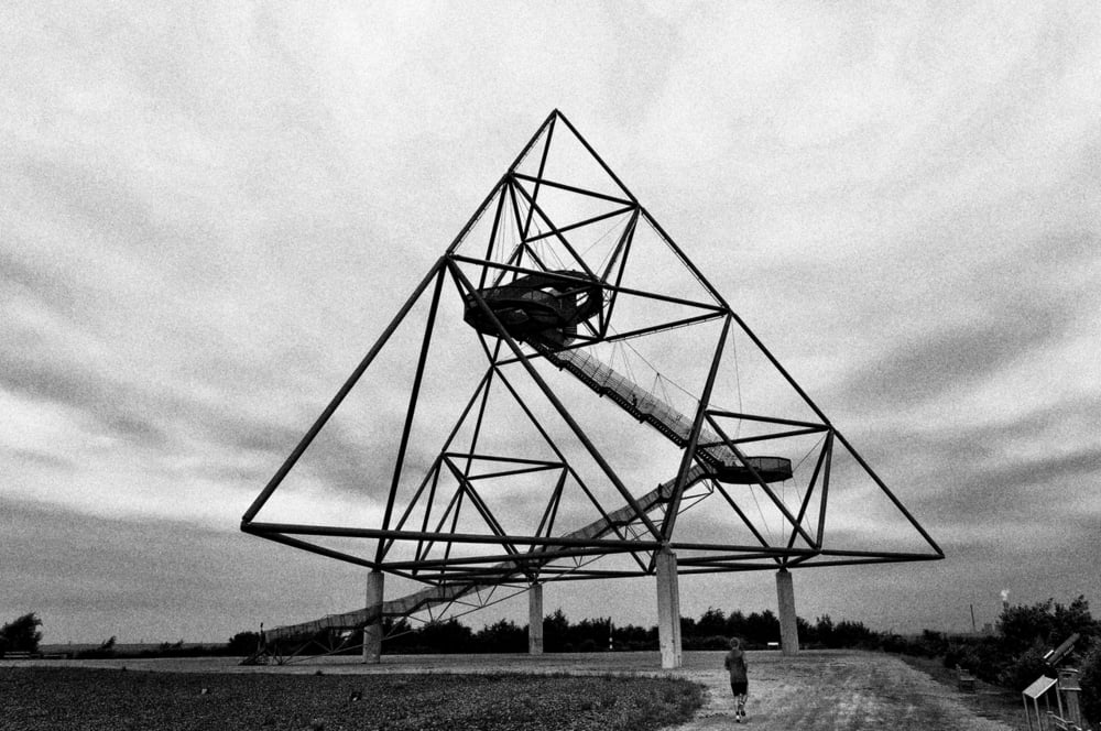
Von dort aus in nordwestlicher Richtung zum weithin sichtbaren Tetraeder (Bottrop). Dort hat man einen guten Blick auf die noch aktive Kokerei Prosper (Bottrop).
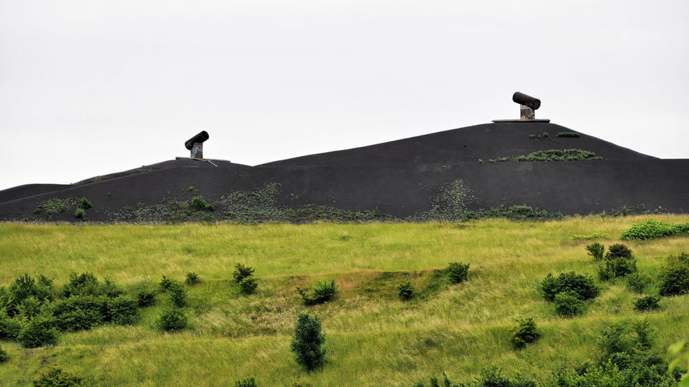
Vorbei an der Halde 22 (Bottrop) zur Rungenberghalde (Gelsenkirchen) mit ihrer Lichtinstallation 'Nachtzeichen' von Hermann EsRichter und Klaus Noculak.
Durch den Gelsenkirchener Stadtwald nach Norden zum Schloss Westerholt (Herten) und schließlich weiter zum Schloss Herten und zurück zum Ausgangspunkt Recklinghausen.
Further information at
http://www.panoramio.com/user/1739782/tags/Tour%201?photo_page=1Galerija izletov
Zemljevid in višinski profil izleta
Minimum height 26 m
Maximum height 149 m
More about the tour author

|
plattapuss |
Komentarji

Start am LIDL-Parkplatz an der Hertener Straße Recklinghausen ( N51 36.580 E7 10.888 )
Poti GPS
Trackpoints-
GPX / Garmin Map Source (gpx) download
-
TCX / Garmin Training Center® (tcx) download
-
CRS / Garmin Training Center® (crs) download
-
Google Earth (kml) download
-
G7ToWin (g7t) download
-
TTQV (trk) download
-
Overlay (ovl) download
-
Fugawi (txt) download
-
Kompass (DAV) Track (tk) download
-
List z izleti (pdf) download
-
Original file of the author (gpx) download
More about the tour author
|
|
plattapuss |
Add to my favorites
Remove from my favorites
Edit tags
Open track
My score
Rate