

Nachdem ich wenig Touren gefunden haben die beschrieben waren, mach ich es jetzt mal selber.
Ausgangspunkt war bei uns immer der Campingplatz von Njivice.
Straßen waren alle super fürs Rennrad und sehr wenig befahren.
Auf der 102 war der Verkehr allerdings rel. stark und da macht das fahren m.M. wenig Spaß, von daher hab ich mich meist Abseits von der Hauptstrasse bewegt und den nördlichen Teil befahren.
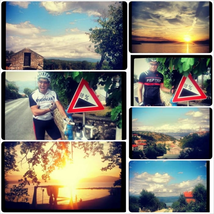
Die Hafenstädte Silo, Vrbnik und Saline liegen wie der Name schon sagt am Meer, was einersteits tolle Abfahrten zwischen 10 und 18 Prozent beschert..aber auch die Anstiege auf dem Weg zurück ;)
english by Google ..
After I have found little trips were described, I make it by myself now.
The starting point was always the campsite of Njivice .
Roads were all great for a racing bike and very little traffic.
On the 102, the traffic was rel. strong and there makes the drive little fun, so I got myself mostly moved away from the main road and drive on the northern part.
The port cities silo, Vrbnik and saline are as the name suggests, the sea, which brings great runs 10 to 18 percent .. but the climbs on the way back;)
Zemljevid in višinski profil izleta
Minimum height 37 m
Maximum height 323 m
More about the tour author

|
Bluebird76 |
Komentarji

Poti GPS
Trackpoints-
GPX / Garmin Map Source (gpx) download
-
TCX / Garmin Training Center® (tcx) download
-
CRS / Garmin Training Center® (crs) download
-
Google Earth (kml) download
-
G7ToWin (g7t) download
-
TTQV (trk) download
-
Overlay (ovl) download
-
Fugawi (txt) download
-
Kompass (DAV) Track (tk) download
-
List z izleti (pdf) download
-
Original file of the author (gpx) download
More about the tour author
|
|
Bluebird76 |
Add to my favorites
Remove from my favorites
Edit tags
Open track
My score
Rate