


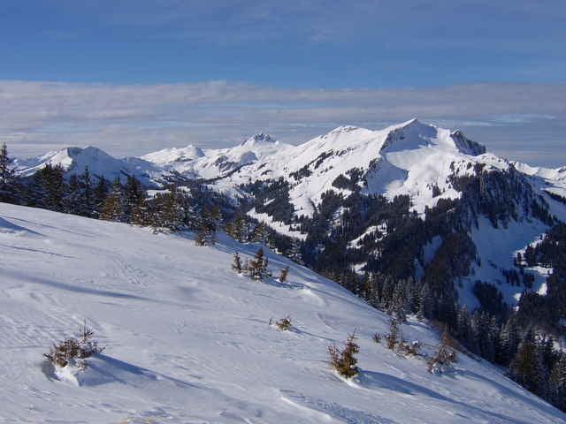
einfache Skitour (bei LW3 meist machbar) von Au aus auf der Nordseite zum Hohen Lug.
Start in Au bei der Kirche, Richtung Bergstation Grundholzlift, weiter auf dem Güterweg Richtung Kristalhütte. Am Waldende dann auf Almwiesen zum Hohen Lug.
Der Track startet bei der Ailinger Hütte.
Der Hohe Lug kann von der Argenbrücke (nach Au Richtung Damüls) auch auf der Südseite bestiegen / befahren werden (Weg siehe Radtour).
Galerija izletov
Zemljevid in višinski profil izleta
Minimum height 819 m
Maximum height 1780 m
More about the tour author
|
|
skyhopper |
Komentarji

auf B200 von Dornbirn über Mellau nach Au. Dann Richtung Damüls abbiegen und nach ca. 100m bei der Raiffeisenbank links bis zum Gemeindeamt / Post. Hier hat es einen Parkplatz.
Ansonsten sollte man beim Freibad Au parken können.
Ansonsten sollte man beim Freibad Au parken können.
Poti GPS
Trackpoints-
GPX / Garmin Map Source (gpx) download
-
TCX / Garmin Training Center® (tcx) download
-
CRS / Garmin Training Center® (crs) download
-
Google Earth (kml) download
-
G7ToWin (g7t) download
-
TTQV (trk) download
-
Overlay (ovl) download
-
Fugawi (txt) download
-
Kompass (DAV) Track (tk) download
-
List z izleti (pdf) download
-
Original file of the author (gpx) download
More about the tour author
|
|
skyhopper |
Add to my favorites
Remove from my favorites
Edit tags
Open track
My score
Rate