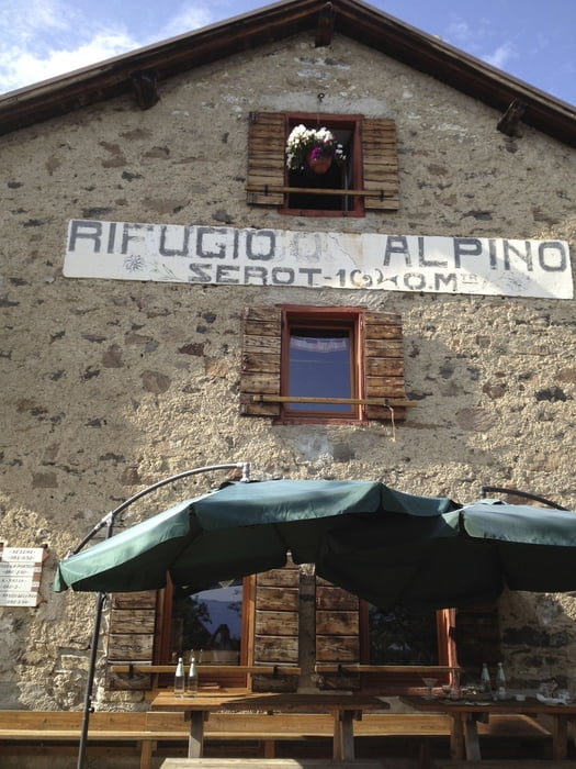
Du startest in San Cristofero a Lago und fährts über Assizzi und Vigola Falesina nach Compet. Weiter auf Asphalt schlängelt sich die Strasse bis zum Skigebiet Panarotta. Von dort zieht sich ein Schotterweg nach la Bassa. weiter geht es einen schönen Trail zum Rifugio Serot. Dort kanst du hervorragend essen und auch übernachten. Roberto freut sich! Wenn du noch Kraft in den Beinen hast nimmst du den Weg nach La Bassa zurück. Von dort genießt du einen hervorragenden Blick auf die Dolomiten. Jetzt beginnt die Abfahrt zunächst auf Wanderwegen, ab Vetriolo Therme fährst du auf dem Sentiero della Pace zu großen Teilen auf Single trail. 800 hm feinster Trail warten auf dich! Ab hm 560 erreichst dann die asphaltierte Strasse nach Pergine. Und von dort kommst du wie auf den Hinweg zurück nach San Cristofero. Ein Srung in den See und danch ein kühles Getränk in den Bars. Ein perfekter MTB Tag!
Galerija izletov
Zemljevid in višinski profil izleta
Minimum height 450 m
Maximum height 1884 m
Komentarji

Poti GPS
Trackpoints-
GPX / Garmin Map Source (gpx) download
-
TCX / Garmin Training Center® (tcx) download
-
CRS / Garmin Training Center® (crs) download
-
Google Earth (kml) download
-
G7ToWin (g7t) download
-
TTQV (trk) download
-
Overlay (ovl) download
-
Fugawi (txt) download
-
Kompass (DAV) Track (tk) download
-
List z izleti (pdf) download
-
Original file of the author (gpx) download
Add to my favorites
Remove from my favorites
Edit tags
Open track
My score
Rate


