Login

Si pozabil/a podatke za prijavo?

Cookies have to be accepted!
Your browser's cookie functionality is disabled. Please enable this functionality.

Not a member yet?

Register now
Login

Available for registred users only

Log in to use this feature.

Si pozabil/a podatke za prijavo?

Cookies have to be accepted!
Your browser's cookie functionality is disabled. Please enable this functionality.

Not a member yet?

Register now
Filter
Kategorije
Advanced filters
  • Dolžina (km)
  • Metri nadmorske višine
Shrani filter Reset filter

TrackRank

QRCode

Technical data

Dolžina30,6 km Metri nadmorske višine553 m Way down553 m Trajanje3 days 0 h Datum31.01.2015
Ocene Author User Pokrajina Dejavnik zabave Kondicija Tehnika

Statistika

607 Pogledi 1 Ocena 171 Prenosi 3.00 Povprečje
Rate
  • List z izleti
  • Prihod
  • Prenosi

hele mooie tocht door een gebied wat eigenlijk niet door veel toeristen wordt bezocht .

komt heel soms wandelaars tegen wat geen problemen geeft.

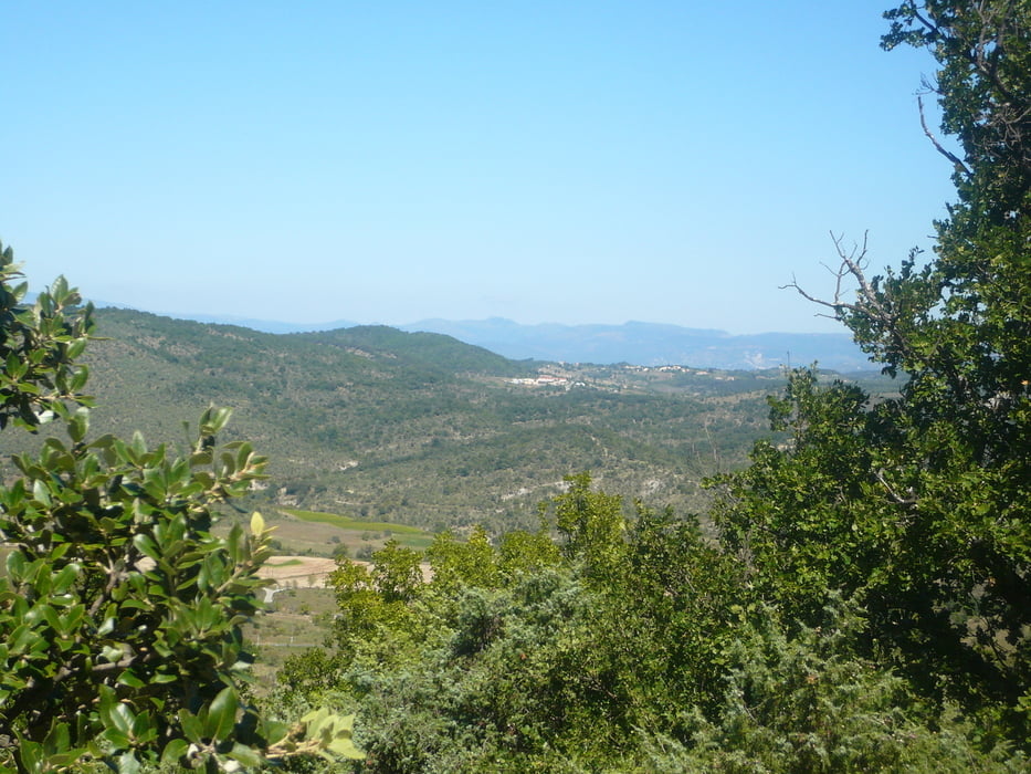
het uitzicht is een mengelmoesje van bosrijk tot panoramo uitzicht over vallon pont D'Árc


Galerija izletov

Zemljevid in višinski profil izleta

  • Open Street Map
  • Google
Minimum height 86 m Maximum height 348 m Prikaz podrobnosti

More about the tour author

badmuts
Member since 2014

Send private message

Komentarji

sentiero601 on 30.08.2018

Stones! Stones! Stones!

No funny downhills. Uphills also sometimes impossible to ride when paths are consisting of loose stones.
Insane 30% uphill on loose stones!
sentiero601 on 30.08.2018

Stones! Stones! Stones!

No funny downhills. Uphills also sometimes impossible to ride when paths are consisting of loose stones.
Insane 30% uphill on loose stones!

start vanuit vallon pont d'arc

gaat u richting villeneuve d berg (geografich gezien) en voert u door de val d. l'bie 

met een hele zware klim over losse stenen van 30% en loopt over een hele mooie heuvelrug .


Poti GPS

Trackpoints
  • GPX / Garmin Map Source (gpx) download
  • TCX / Garmin Training Center® (tcx) download
  • CRS / Garmin Training Center® (crs) download
  • Google Earth (kml) download
  • G7ToWin (g7t) download
  • TTQV (trk) download
  • Overlay (ovl) download
  • Fugawi (txt) download
  • Kompass (DAV) Track (tk) download
  • List z izleti (pdf) download
  • Original file of the author (gpx) download

More about the tour author

badmuts
Member since 2014

Send private message
Share track
Add to my favorites
Remove from my favorites
Edit tags
My score
Rate
Izlet: tour val de L'Bie
Vrsta: Gorsko kolo
Dolžina: 30,6 km
Evaluated on:
Trajanje:
Day(s)
Hour(s)
Minute(s)
Ocena: Pokrajina Dejavnik zabave Kondicija Tehnika