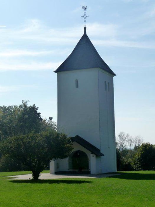
Sehr gut ausgeschilderter Rundweg. Gestartet am Parkplatz Birkhof und dann der Beschilderung KL folgen. Die ersten ca. 3km gehen nahe an der Landstraße und Autobahn entlang, danach wird es aber ein ruhiger Waldwanderweg. Am Swister Türmchen triftt man auf den Jakobs Pilgerpfad. Weiter gehts dann über Schnacke Jagdweg am Bergeistsee entlang zum Lucretiasee und zurück zum Birkhof. Hier kann man dann gut einkehren und Durst und Hunger stillen.
Galerija izletov
Zemljevid in višinski profil izleta
Komentarji

Anfahrt:
Da es sich um einen Rundwanderweg handelt, ist der Start-/Zielpunkt frei wählbar.
Mit dem PKW bieten sich die Parkplätze "Swister Türmchen", "Rahmbusch", "Schnacke Jagdweg", "Birkhof" und "Berggeist" an.
Mit dem Bus erreicht man den Klüttenweg am besten mit der Linie 985, die von Euskirchen über Weilerswist nach Brühl (und entgegengesetzt) verkehrt. Die Haltestellen "Birkhof" und "Swisterberg" liegen direkt am Weg.
Vom Bahnhof Weilerswist sind es zu Fuß ca. 3 km bis zum Weg (teils leicht bergauf), von den Bahnhöfen Brühl, Kierberg, Sechtem sind es jeweils 5,5 bis 6 km bis zum Weg.
Poti GPS
Trackpoints-
GPX / Garmin Map Source (gpx) download
-
TCX / Garmin Training Center® (tcx) download
-
CRS / Garmin Training Center® (crs) download
-
Google Earth (kml) download
-
G7ToWin (g7t) download
-
TTQV (trk) download
-
Overlay (ovl) download
-
Fugawi (txt) download
-
Kompass (DAV) Track (tk) download
-
List z izleti (pdf) download
-
Original file of the author (gpx) download


