
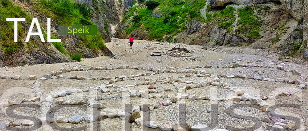

Eine sehr nette kleine Wanderung in Bayrisch Gmain. Unzählige Wasserstufen und Bachläufe laden zum Verweilen ein. Am Ende des Tales eröffnet sich ein breites Kiesbett wo allerlei Spirituelles zu entdecken ist. Besonders an heißen Sommertagen sehr empfehlenswert.
Mehr dazu >>> HIER
Further information at
http://www.satcom.at/speik/Galerija izletov


Zemljevid in višinski profil izleta
Minimum height 564 m
Maximum height 830 m
More about the tour author
|
|
GarminSalzburg |
Komentarji

In Bayrisch Gmain fahren Sie von Bad Reichenhall kommend Richtung Berchtesgaden durch und achten dann auf das Hinweisschild Friedhof. Dort beim Bergfriedhof gibt es genügend Parplätze
Poti GPS
Trackpoints-
GPX / Garmin Map Source (gpx) download
-
TCX / Garmin Training Center® (tcx) download
-
CRS / Garmin Training Center® (crs) download
-
Google Earth (kml) download
-
G7ToWin (g7t) download
-
TTQV (trk) download
-
Overlay (ovl) download
-
Fugawi (txt) download
-
Kompass (DAV) Track (tk) download
-
List z izleti (pdf) download
-
Original file of the author (gpx) download
More about the tour author
|
|
GarminSalzburg |
Add to my favorites
Remove from my favorites
Edit tags
Open track
My score
Rate