

- Start: Bergstation Weissensee Bergbahn/Techendorf
- Ziel: Talstation Weissensee Bergbahn/Techendorf
- Neu errichteter Single Trail. . Flowig. Ohne Ecken und Kanten. Keine Spitzkehren. Erhöhte Kurven. Wenig Wurzeln. Mit mittlerer Technik leicht zu bewältigen. S1 wenige S2 Stellen. Eröffnung des Trails am Samstag, 25.6.16. Mit Erlaubnis der Bahnverwaltung durfte ich den Trail vorab aufzeichnen.
- Bahnfahrt zum Start: 12,50 € incl. Rad. Tageskarte 26€. Saisonskarte 118€. Bahnfahrten von 09-17 Uhr.
- Start: 1.326 Mh. Ziel: 965 Mh.
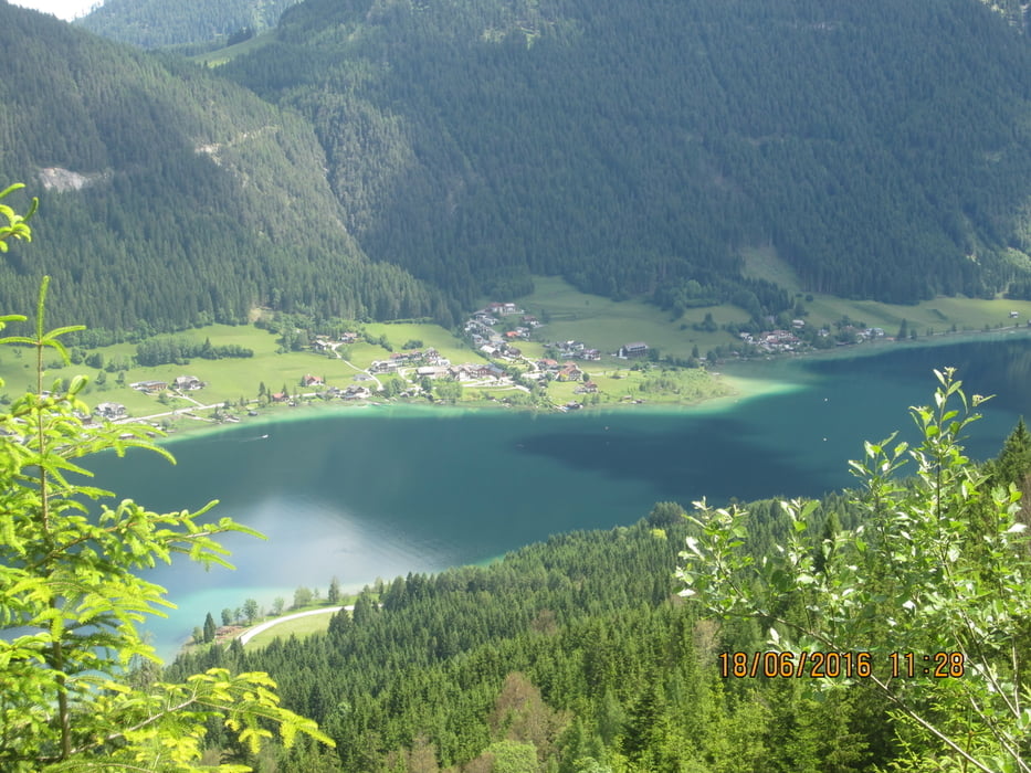
- Mit dem Rad von der Tal- zur Bergstation der Seilbahn: 4,38 Km. - ca. 37 Minuten auf gleichmässigansteigendem Forstweg mit schönem Ausblick auf den See.
PS. Der Trail war trotz des Regens vom Vortag problemlos zu befahren.
Galerija izletov


Zemljevid in višinski profil izleta
Minimum height 957 m
Maximum height 1328 m
More about the tour author
|
|
MargesinFriedrich |
Komentarji

Poti GPS
Trackpoints-
GPX / Garmin Map Source (gpx) download
-
TCX / Garmin Training Center® (tcx) download
-
CRS / Garmin Training Center® (crs) download
-
Google Earth (kml) download
-
G7ToWin (g7t) download
-
TTQV (trk) download
-
Overlay (ovl) download
-
Fugawi (txt) download
-
Kompass (DAV) Track (tk) download
-
List z izleti (pdf) download
-
Original file of the author (gpx) download
More about the tour author
|
|
MargesinFriedrich |
Add to my favorites
Remove from my favorites
Edit tags
Open track
My score
Rate