

Der Mendelpass ist super zu fahren und bietet eine anspruchsvolle, aber gleichmässige Steigung. Oben angekommen kann man noch den Penegal hochfahren, sehr steil aber als Belohnung wartet eine gigantische Aussicht auf das Etschtal. Ich bin bei dieser Tour direkt weitergefahren auf eine sehr angenhem zu fahrende Abfahrt vom Mendel Richtung Molvenosee.
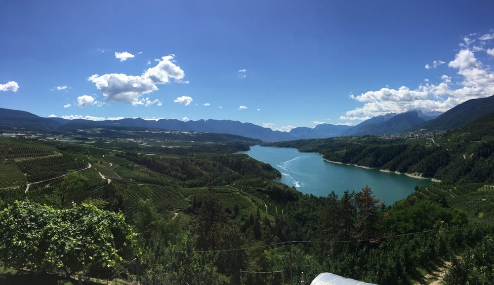
Der Anstieg am Ende ist nochmal recht lang aber ebenfalls ohne tückische Rampen. Der Molvenosee selbst liegt wunderschön in den Bergen, das Wasser hat eine Temparatur, die wirklich erfrischend ist am Ende der Tour;-)
Galerija izletov


Zemljevid in višinski profil izleta
Minimum height 305 m
Maximum height 1367 m
More about the tour author
|
|
wluehdorff |
Komentarji

Der Startpunkt der Tour ist in Kaltern, man kann aber natürlich auch z.B. von Bozen aus starten auf dem Radweg zum Mendel.
Poti GPS
Trackpoints-
GPX / Garmin Map Source (gpx) download
-
TCX / Garmin Training Center® (tcx) download
-
CRS / Garmin Training Center® (crs) download
-
Google Earth (kml) download
-
G7ToWin (g7t) download
-
TTQV (trk) download
-
Overlay (ovl) download
-
Fugawi (txt) download
-
Kompass (DAV) Track (tk) download
-
List z izleti (pdf) download
-
Original file of the author (gpx) download
More about the tour author
|
|
wluehdorff |
Add to my favorites
Remove from my favorites
Edit tags
Open track
My score
Rate