

Dit is de vijfde dag van de fietstocht langs de Hadrianus muur en Wainwrights Coast to coast route. De low budget route gaat van camping naar camping. Het gedeelte langs de Hadrianus muur volgt de National Cycle Route 72 tot Carlisle. Na Carlisle buigt de track in richting van St. Bees, het startpunt van Wainwrights coast to coast van de Ierse zee naar de Noordzee.. Deze coast to coast route is van oorsprong een wandelpad. Ik heb geprobeerd om fietspaden en stille wegen op te nemen die zo dicht mogelijk bij de wandelroute liggen.
This is the fifth day of the cycle route along the Hadrian's Wall and Wainwrights Coast tot Coast.
The low budget route goes from campsite to campsite . The part along the Hadrian's Wall follows the National Cycle Route 72 till Carlisle. After Carlisle the track bends in the direction of St. Bees the starting point of Wainwrights Coast to Coast from the Irish sea to the North sea. This coast to coast route is a walking route. I tried to use cyclingpaths and quiet roads that are situated as near as possible to the walkingroute.
Zemljevid in višinski profil izleta
Minimum height 99999 m
Maximum height -99999 m
More about the tour author

|
partnair |
Komentarji

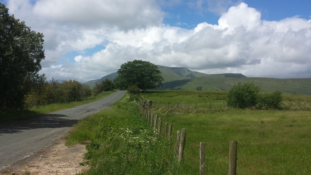
De route van vandaag gaat door het magnifieke Lake District. Vanaf de camping in Keswick zou je via het Keswick Railway fietspad moeten rijden. Helaas zijn tijdens de najaarsstormen 2 bruggen over de Greta rivier weggespoeld waardoor dit pad is geblokkeerd.. Informeer eerst of de bruggen hersteld zijn. Als dat niet het geval is moet je via de A66 naar Threlkeld om daar de route weer op te pakken. Even na Penruddock steek je de A66 over richting het Ullswater meer. Hier kun je genieten van het uitzicht over het grote meer.
In Pooley bridge is een café waar je even wat kunt drinken.
De rest van de deze trip is een aaneenschakeling van wisselende landschappen en prachtige uitzichten.
In Shap is de kans groot dat je de wandelende of strompelende collega backpackers tegen komt.
Na Shap verandert het landschap en verlaat je Lake district en ben je weer terug in de Pennines..
De camping Pennine view in Kirkby Stephen was de eerste camping die rekening heeft gehouden met hikers en bikers. De dame die me ontving was bijzonder vriendelijk en behulpzaam.
Today's route crosses the magnificent Lake district. From the campsite in Keswick you should ride via the Keswick railway path. Unfortunately two bridges over Greta river were washed away during autumnstorms. The path was blocked. Please inform before if the bridges are repaired.
If not you you will have to take the A66 to Threlkeld to pick up the track again. After Penruddock you cross over the A 66 to start the descend to Lake Ullswater. Here you will enjoy the nice view over the lake.
In Pooley bridge there is a café to have a drink.
The rest of this trip are a series of changing landscapes en beuatifull views.
In Shap you have a good chanche to meet the Coast to coast walker or crippled colleague backpacker.
After Shap the landscape changes and there you leave the Lake district to enter the Pennines again.
The campsite Pennine View in Kirkby Stephen was the first campsite that has taken care for hikers and bikers. The lady who welcomed me was very kind and helpfull.
Poti GPS
Trackpoints-
GPX / Garmin Map Source (gpx) download
-
TCX / Garmin Training Center® (tcx) download
-
CRS / Garmin Training Center® (crs) download
-
Google Earth (kml) download
-
G7ToWin (g7t) download
-
TTQV (trk) download
-
Overlay (ovl) download
-
Fugawi (txt) download
-
Kompass (DAV) Track (tk) download
-
List z izleti (pdf) download
-
Original file of the author (gpx) download
More about the tour author
|
|
partnair |
Add to my favorites
Remove from my favorites
Edit tags
Open track
My score
Rate