Login

Si pozabil/a podatke za prijavo?

Cookies have to be accepted!
Your browser's cookie functionality is disabled. Please enable this functionality.

Not a member yet?

Register now
Login

Available for registred users only

Log in to use this feature.

Si pozabil/a podatke za prijavo?

Cookies have to be accepted!
Your browser's cookie functionality is disabled. Please enable this functionality.

Not a member yet?

Register now
Filter
Kategorije
Advanced filters
  • Dolžina (km)
  • Metri nadmorske višine
Shrani filter Reset filter

TrackRank

QRCode

Technical data

Dolžina24,2 km Metri nadmorske višine1020 m Way down1015 m Trajanje02:30 h:m Datum01.07.2005
Ocene Author Pokrajina Dejavnik zabave Kondicija Tehnika

Statistika

8084 Pogledi 1 Ocena 1114 Prenosi 4.00 Povprečje
Rate
  • List z izleti
  • Prihod
  • Prenosi
2008 neue Strecke!

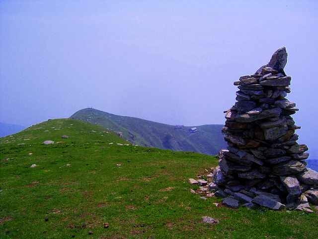
Tour auf Teerstraße von Domaso über Gravedona (neue Strecke), Peglio (Nähe Lirio) zum hochgelegenen Örtchen Bodone. Abfahrt über schmalen Wanderweg nach Peglio, über Straße nach Naro Trimdichpfad und verschiedene Eselwege zurück nach Domaso.

In Bodone geht kann man auf den Gipfel des Mt. Fiorita laufen (siehe Wanderungen), mit dem Rad ist der Aufstieg mühsam, in der Höhe kann man das meiste fahren. Hinunter an die Fahrstraße kann man kaum fahren (also lohnt es sich eher nicht).

At the tourist office (i.g. head quater Domaso) you can buy the excellent map "Alto Lario" 1:35.000 (or ISBN 88-900896-2-8 6,20Euro)


Further information at

http://www.casarina.com/

Galerija izletov

Zemljevid in višinski profil izleta

  • Open Street Map
  • Google
Minimum height 224 m Maximum height 1170 m Prikaz podrobnosti

More about the tour author

skyhopper
Member since 2005

Send private message

Komentarji

Boris on 30.08.2007

Abfahrt von Naro

Tolle Singel Trail Abfahrt. Habe kaum soviel bremsbelag vernichtet. Aber 1km nach Naro, (nach der Brücke über das Rohr) hatte ich Schwierigkeiten den nicht vorhanden Weg zu folgen/finden.

Hallo, ich hab die Strecke neu aufgenommen so daß die Tour jetzt komplett fahrbar und auffindbar ist. Die Abfahrt auf dem Trimmdichpfad Naro-Segna ist klasse, der Weg nach Bodone geht jetzt zurest über die Straße und dann erst tiefer in den schönen Waldtrail, leider etwas verwildert.
Crissi on 22.11.2009

Unterkunft

Hi, wie war denn die Unterkunft "Casa Rina"?

Bei Holidaycheck.deist die Bewertung ja alles andere als berauschend!!!!
Domaso/Gravedona liegt am nördlichen Ende des Comer Sees.

From Chur coming go direction San Bernardino, at Splügen go right to passo de Splügen and from there to the lago di Como (Lario). Here right direction to Lugano (not Lecco).

Poti GPS

Trackpoints
  • GPX / Garmin Map Source (gpx) download
  • TCX / Garmin Training Center® (tcx) download
  • CRS / Garmin Training Center® (crs) download
  • Google Earth (kml) download
  • G7ToWin (g7t) download
  • TTQV (trk) download
  • Overlay (ovl) download
  • Fugawi (txt) download
  • Kompass (DAV) Track (tk) download
  • List z izleti (pdf) download
  • Original file of the author (gpx) download

More about the tour author

skyhopper
Member since 2005

Send private message
Share track
Add to my favorites
Remove from my favorites
Edit tags
My score
Rate
Izlet: Lago di Como - Domaso - Bodone
Vrsta: Gorsko kolo
Dolžina: 24,2 km
Evaluated on:
Trajanje:
Day(s)
Hour(s)
Minute(s)
Ocena: Pokrajina Dejavnik zabave Kondicija Tehnika