Login

Si pozabil/a podatke za prijavo?

Cookies have to be accepted!
Your browser's cookie functionality is disabled. Please enable this functionality.

Not a member yet?

Register now
Login

Available for registred users only

Log in to use this feature.

Si pozabil/a podatke za prijavo?

Cookies have to be accepted!
Your browser's cookie functionality is disabled. Please enable this functionality.

Not a member yet?

Register now
Filter
Kategorije
Advanced filters
  • Dolžina (km)
  • Metri nadmorske višine
Shrani filter Reset filter

TrackRank

QRCode

Technical data

Dolžina41,1 km Metri nadmorske višine1563 m Way down1540 m Trajanje04:45 h:m Datum16.06.2008
Ocene Author Pokrajina Dejavnik zabave Kondicija Tehnika

Statistika

1261 Pogledi 1 Ocena 283 Prenosi 4.00 Povprečje
Rate
  • List z izleti
  • Prihod
  • Prenosi

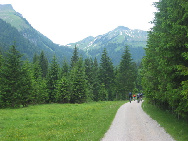
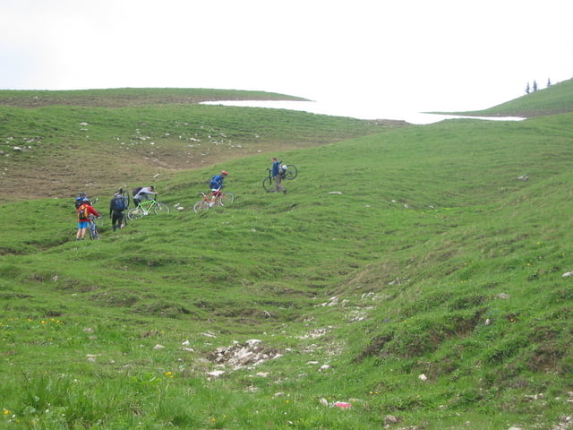
Landschaftlich sehr schöne Tour mit mittleren Anforderungen an Kondition und Fahrtechnik


Ab der Gröbenalm Trage- und Schiebestrecke, zunächst aufwärts bis zum Gröbner Hals, dann abwärts bis zum Lochalm Hochleger.

Galerija izletov

Zemljevid in višinski profil izleta

  • Open Street Map
  • Google
Minimum height 840 m Maximum height 1830 m Prikaz podrobnosti

More about the tour author

pemu1958
Member since 2008

Send private message

Komentarji

kaiser_99 on 08.06.2012

Stand 7.6.2012

Der Weg der Trag und Schiebestrecke ist zu Zeit abgerutscht. Extra Zeit einplanen.Sehr schöne Tour! Ich bin Sie umgekehrt gefahren, weil ich am Schluss nicht auf der vielbefahrenen Strasse bergauffahren will.

Poti GPS

Trackpoints
  • GPX / Garmin Map Source (gpx) download
  • TCX / Garmin Training Center® (tcx) download
  • CRS / Garmin Training Center® (crs) download
  • Google Earth (kml) download
  • G7ToWin (g7t) download
  • TTQV (trk) download
  • Overlay (ovl) download
  • Fugawi (txt) download
  • Kompass (DAV) Track (tk) download
  • List z izleti (pdf) download
  • Original file of the author (gpx) download

More about the tour author

pemu1958
Member since 2008

Send private message
Share track
Add to my favorites
Remove from my favorites
Edit tags
My score
Rate
Izlet: Von Achenkirch um den Juifen
Vrsta: Gorsko kolo
Dolžina: 41,1 km
Evaluated on:
Trajanje:
Day(s)
Hour(s)
Minute(s)
Ocena: Pokrajina Dejavnik zabave Kondicija Tehnika