

Abstieg über den Gippelsteig
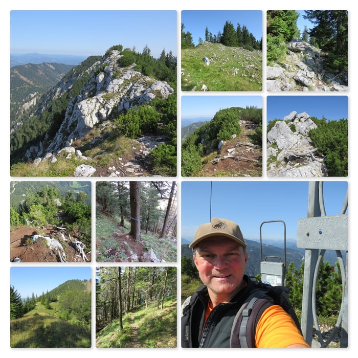
Am Gippeltörl Wegweiser gibt es keinen Hinweis auf den Gippelsteig (blau/weiß). Daher geht man die ersten 100 m über die Alm und hält sich eher oben am Grat. Bald aber findet man die ersten Markierungssteine und folgt diesen über den Schwarzauer Gippel (1605m), und dann steil und rutschig hinunter bis zum Preinecksattel.
Bei der Weggabelung nimmt man den schmalen Steig auf der linken Seite und folgt diesem steilen, beschwerlichen Weg bis ins Tal hinunter.
Further information at
https://de.wikipedia.org/wiki/GippelZemljevid in višinski profil izleta
Minimum height 694 m
Maximum height 1663 m
More about the tour author
|
|
huberj59 |
Komentarji

Parkplatz an den Koordinaten: N47° 49' 32.8" E15° 35' 51.1"1
Adresse: Zögernitz, Weißenbach 77
Mosheuriger Wieser
Start der Wanderung: N47° 49' 33.0" E15° 35' 51.1"
Poti GPS
Trackpoints-
GPX / Garmin Map Source (gpx) download
-
TCX / Garmin Training Center® (tcx) download
-
CRS / Garmin Training Center® (crs) download
-
Google Earth (kml) download
-
G7ToWin (g7t) download
-
TTQV (trk) download
-
Overlay (ovl) download
-
Fugawi (txt) download
-
Kompass (DAV) Track (tk) download
-
List z izleti (pdf) download
-
Original file of the author (gpx) download
More about the tour author
|
|
huberj59 |
Add to my favorites
Remove from my favorites
Edit tags
Open track
My score
Rate