Login

Si pozabil/a podatke za prijavo?

Cookies have to be accepted!
Your browser's cookie functionality is disabled. Please enable this functionality.

Not a member yet?

Register now
Login

Available for registred users only

Log in to use this feature.

Si pozabil/a podatke za prijavo?

Cookies have to be accepted!
Your browser's cookie functionality is disabled. Please enable this functionality.

Not a member yet?

Register now
Filter
Kategorije
Advanced filters
  • Dolžina (km)
  • Metri nadmorske višine
Shrani filter Reset filter

TrackRank

QRCode

Technical data

Dolžina8,9 km Metri nadmorske višine189 m Way down127 m Trajanje03:00 h:m Datum19.09.2021
Ocene Author Pokrajina Dejavnik zabave Kondicija Tehnika

Statistika

128 Pogledi Ocene 17 Prenosi Povprečje
Rate
  • List z izleti
  • Prihod
  • Prenosi

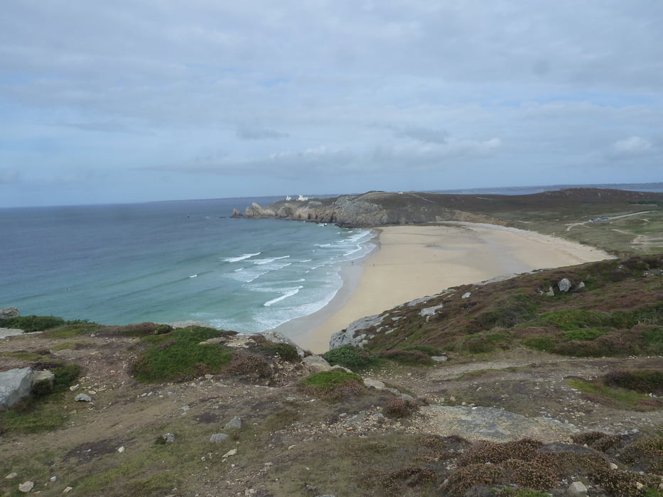
Sehr schöne Wanderung entlang der Steilküste. Es ist viel geboten:

Menhire, Strand, Steilküste, Bunker, schöne Häuser

Man könnte es sicher in der halben Zeit schaffen, wenn man sich beeilt. Aber dann verpasst man die atemberaubende Landschaft.

Galerija izletov

Zemljevid in višinski profil izleta

  • Open Street Map
  • Google
Minimum height -11 m Maximum height 64 m Prikaz podrobnosti

More about the tour author

buehlems
Member since 2008

Send private message

Komentarji

Poti GPS

Trackpoints
  • GPX / Garmin Map Source (gpx) download
  • TCX / Garmin Training Center® (tcx) download
  • CRS / Garmin Training Center® (crs) download
  • Google Earth (kml) download
  • G7ToWin (g7t) download
  • TTQV (trk) download
  • Overlay (ovl) download
  • Fugawi (txt) download
  • Kompass (DAV) Track (tk) download
  • List z izleti (pdf) download
  • Original file of the author (gpx) download

More about the tour author

buehlems
Member since 2008

Send private message
Share track
Add to my favorites
Remove from my favorites
Edit tags
My score
Rate
Izlet: Pointe de Pen Hir
Vrsta: Pešačenje
Dolžina: 8,9 km
Evaluated on:
Trajanje:
Day(s)
Hour(s)
Minute(s)
Ocena: Pokrajina Dejavnik zabave Kondicija Tehnika