Login

Si pozabil/a podatke za prijavo?

Cookies have to be accepted!
Your browser's cookie functionality is disabled. Please enable this functionality.

Not a member yet?

Register now
Login

Available for registred users only

Log in to use this feature.

Si pozabil/a podatke za prijavo?

Cookies have to be accepted!
Your browser's cookie functionality is disabled. Please enable this functionality.

Not a member yet?

Register now
Filter
Kategorije
Advanced filters
  • Dolžina (km)
  • Metri nadmorske višine
Shrani filter Reset filter

TrackRank

QRCode

Technical data

Dolžina11,6 km Metri nadmorske višine328 m Way down363 m Trajanje00:00 h:m Datum28.03.2022
Ocene Author Pokrajina Dejavnik zabave Kondicija Tehnika

Statistika

207 Pogledi Ocene 6 Prenosi Povprečje
Rate
  • List z izleti
  • Prihod
  • Prenosi

Wanderung aus dem Wanderbuch "Fränkisches Weinland mit Taubertal" die Nr.47 - "Von Creglingen nach Standorf" -


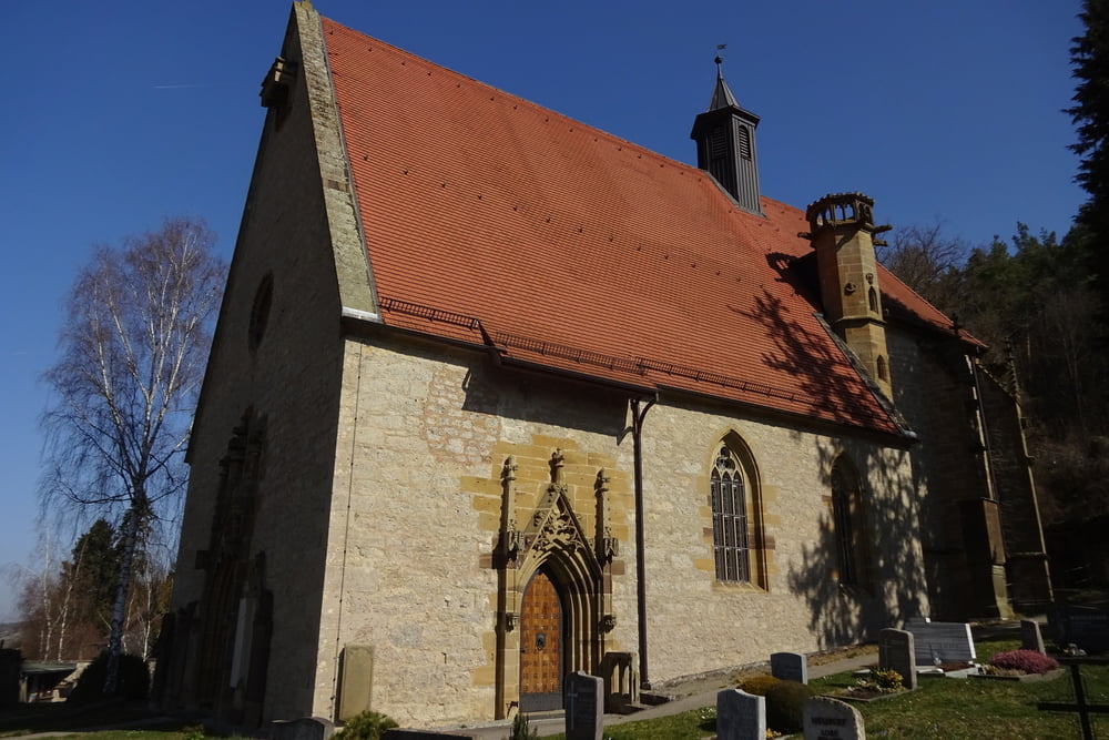
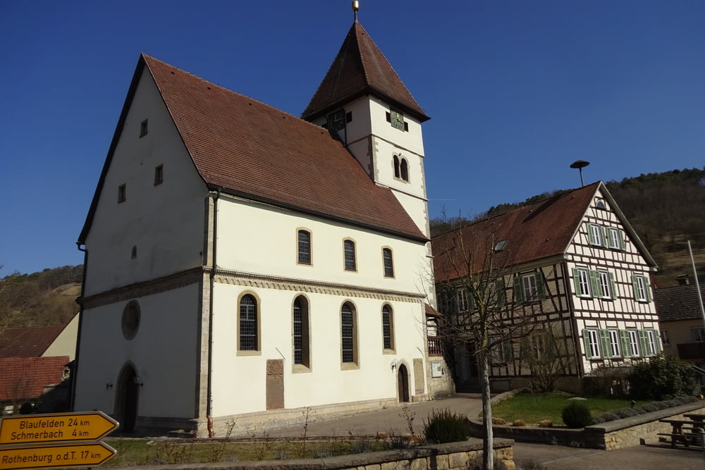
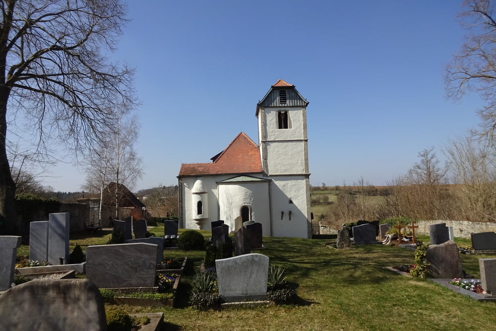
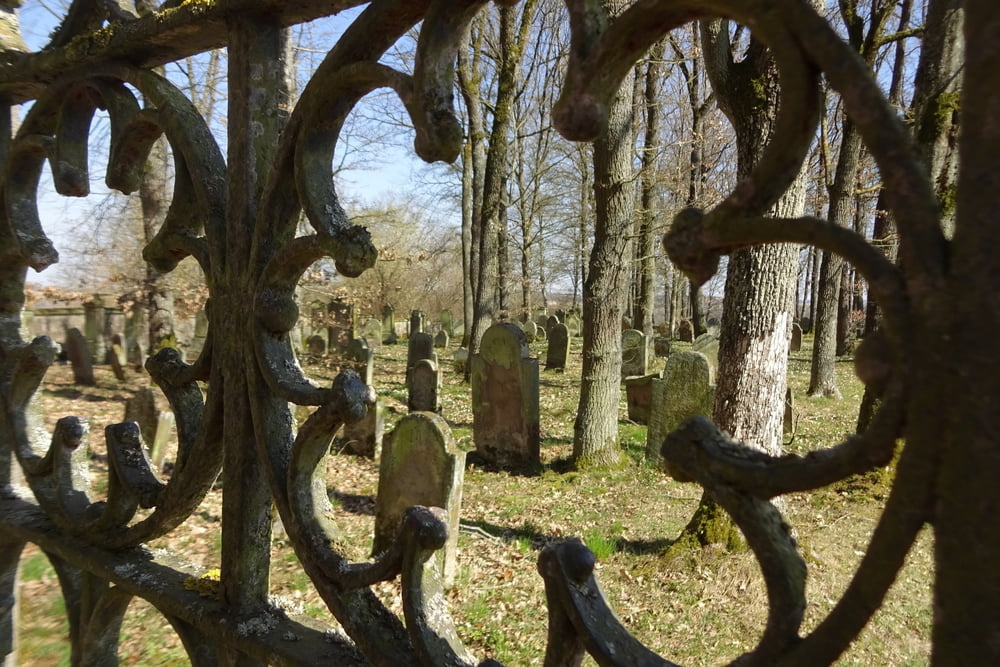
Ein entspannte Tour mit viel Kultur: Herrgottskirche mit einem Riemenschneider-Altar (1505 bis 1510 entstanden) - Münster in Münster - Ulrichskapelle und Ulrichsquelle - Jüdischer Friedhof


Start und Endpunkt: Parkplatz neben der Tauberbrücke im Ort


Viel Spaß!

Galerija izletov

Zemljevid in višinski profil izleta

  • Open Street Map
  • Google
Minimum height 210 m Maximum height 449 m Prikaz podrobnosti

More about the tour author

FLU
Member since 2009

Send private message

Komentarji

Poti GPS

Trackpoints
  • GPX / Garmin Map Source (gpx) download
  • TCX / Garmin Training Center® (tcx) download
  • CRS / Garmin Training Center® (crs) download
  • Google Earth (kml) download
  • G7ToWin (g7t) download
  • TTQV (trk) download
  • Overlay (ovl) download
  • Fugawi (txt) download
  • Kompass (DAV) Track (tk) download
  • List z izleti (pdf) download
  • Original file of the author (gpx) download

More about the tour author

FLU
Member since 2009

Send private message
Share track
Add to my favorites
Remove from my favorites
Edit tags
My score
Rate
Izlet: Von Creglingen nach Standorf
Vrsta: Pešačenje
Dolžina: 11,6 km
Evaluated on:
Trajanje:
Day(s)
Hour(s)
Minute(s)
Ocena: Pokrajina Dejavnik zabave Kondicija Tehnika