


Hike and Bike Tour im großen Walsertal.
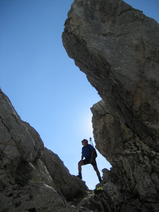
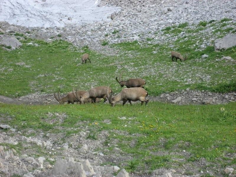
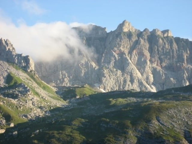
Start war in Sonntag-Garsella. Zunächst etwa 4 Km auf Verkehrsstraße nach Marul. Dann beginnt die Forststraße in angenehmer Steigung zur unteren und weiter zur oberen Laguzalpe. Hier bleiben die Bikes stehen. Nun geht es zu Fuß weiter in zunehmender Steigung zu einer Scharte. Danach erreicht man mit wenigen Metern Höhenverlust den Nordgrat, der in etwa 2500 mtr. Höhe in leichter Kletterei (1-2) zum Gipfel führt. Der Abstieg ist zunächst der gleiche bis zur Abzweigung zur Scharte zwischen Rote Wand und Rothorn. Direkt unterhalb der Scharte zählten wir in unmittelbarer Entfernung etwa 20 Steinböcke. Nachdem wie die Tiere in Ruhe beobachten konnten, ging es direkt hinunter zur Freiburger Hütte. Am nächsten Morgen wanderten wir auf direktem Weg zu den Rädern und fuhren über die Breithornhütte zurück zum Ausgangspunkt.
Galerija izletov

Zemljevid in višinski profil izleta
Minimum height 725 m
Maximum height 2707 m
More about the tour author
|
|
yr1willi |
Komentarji

von Bludenz im Montafon Richtung Faschinajoch bis Sonntag-Garsella.
Poti GPS
Trackpoints-
GPX / Garmin Map Source (gpx) download
-
TCX / Garmin Training Center® (tcx) download
-
CRS / Garmin Training Center® (crs) download
-
Google Earth (kml) download
-
G7ToWin (g7t) download
-
TTQV (trk) download
-
Overlay (ovl) download
-
Fugawi (txt) download
-
Kompass (DAV) Track (tk) download
-
List z izleti (pdf) download
-
Original file of the author (gpx) download
More about the tour author
|
|
yr1willi |
Add to my favorites
Remove from my favorites
Edit tags
Open track
My score
Rate