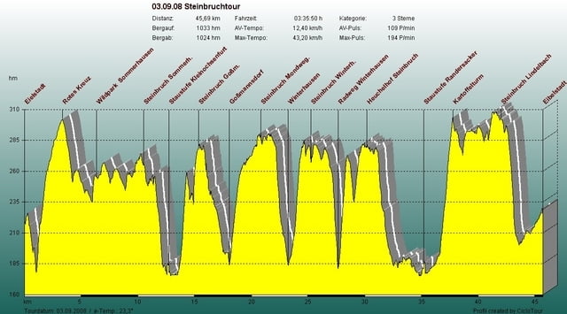
Rundkurs rund um Eibelstadt durch 6 Steinbrüche.
Zemljevid in višinski profil izleta
Minimum height 169 m
Maximum height 305 m
Komentarji
Start und Ziel in Eibelstadt
Poti GPS
Trackpoints-
GPX / Garmin Map Source (gpx) download
-
TCX / Garmin Training Center® (tcx) download
-
CRS / Garmin Training Center® (crs) download
-
Google Earth (kml) download
-
G7ToWin (g7t) download
-
TTQV (trk) download
-
Overlay (ovl) download
-
Fugawi (txt) download
-
Kompass (DAV) Track (tk) download
-
List z izleti (pdf) download
-
Original file of the author (gpx) download
Add to my favorites
Remove from my favorites
Edit tags
Open track
My score
Rate


Brückenabbruch
Derzeit ist allerdings die Querung der A3 über die Brücke bei Lindelbach nicht möglich. Die ist wegen des Autobahnausbaus abgerissen.
Talwärts geht es unter der Autobahn durch.