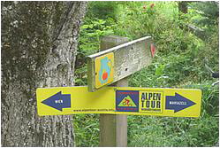
Also check my tour links und rechts von Pappelteich. It has more distance more climbs and more funs (beware that most trails are Wanderwege and you are an 'illegal biker" like me....
Zemljevid in višinski profil izleta
Minimum height 271 m
Maximum height 453 m
Komentarji

Parkplatz Wittgensteinstrasse, 13. Bezirk Wien
Poti GPS
Trackpoints-
GPX / Garmin Map Source (gpx) download
-
TCX / Garmin Training Center® (tcx) download
-
CRS / Garmin Training Center® (crs) download
-
Google Earth (kml) download
-
G7ToWin (g7t) download
-
TTQV (trk) download
-
Overlay (ovl) download
-
Fugawi (txt) download
-
Kompass (DAV) Track (tk) download
-
List z izleti (pdf) download
-
Original file of the author (gpx) download
Add to my favorites
Remove from my favorites
Edit tags
Open track
My score
Rate


