Login

Si pozabil/a podatke za prijavo?

Cookies have to be accepted!
Your browser's cookie functionality is disabled. Please enable this functionality.

Not a member yet?

Register now
Login

Available for registred users only

Log in to use this feature.

Si pozabil/a podatke za prijavo?

Cookies have to be accepted!
Your browser's cookie functionality is disabled. Please enable this functionality.

Not a member yet?

Register now
Filter
Kategorije
Advanced filters
  • Dolžina (km)
  • Metri nadmorske višine
Shrani filter Reset filter

TrackRank

QRCode

Technical data

Dolžina27,5 km Metri nadmorske višine634 m Way down636 m Trajanje01:45 h:m Datum19.09.2008
Ocene Author Pokrajina Dejavnik zabave Kondicija Tehnika

Statistika

468 Pogledi Ocene 99 Prenosi Povprečje
Rate
  • List z izleti
  • Prihod
  • Prenosi

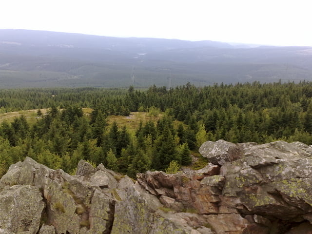
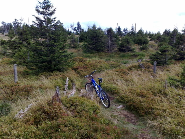
Das war meine erste Tour im Harz, die Strecke ist nicht wirklich weit und hat auch nicht wirklich Höhenmeter, aber ich habe sie als höllisch anstrengend im Sinn :-)


Galerija izletov

Zemljevid in višinski profil izleta

  • Open Street Map
  • Google
Minimum height 621 m Maximum height 906 m Prikaz podrobnosti

More about the tour author

UncleMike
Member since 2008

Send private message

Komentarji

Poti GPS

Trackpoints
  • GPX / Garmin Map Source (gpx) download
  • TCX / Garmin Training Center® (tcx) download
  • CRS / Garmin Training Center® (crs) download
  • Google Earth (kml) download
  • G7ToWin (g7t) download
  • TTQV (trk) download
  • Overlay (ovl) download
  • Fugawi (txt) download
  • Kompass (DAV) Track (tk) download
  • List z izleti (pdf) download
  • Original file of the author (gpx) download

More about the tour author

UncleMike
Member since 2008

Send private message
Share track
Add to my favorites
Remove from my favorites
Edit tags
My score
Rate
Izlet: Hanshühnenburg-Wolfswarte
Vrsta: Gorsko kolo
Dolžina: 27,5 km
Evaluated on:
Trajanje:
Day(s)
Hour(s)
Minute(s)
Ocena: Pokrajina Dejavnik zabave Kondicija Tehnika